We have all been battling storms and bad weather this last week, and especially here on Symi in the last couple of days. We were up during the night on Thursday/Friday, putting down towels, unplugging things and checking the shutters. The storm came in around 1.30 a.m. and then rolled away, came back and rolled past again, then later in the morning on Friday came back again.
This morning
At one point on Friday morning there were two Electricity Board guys outside the house, up the pole, swinging wires around and, I assume, fixing next door’s supply. I did hear a strange ‘bang’ sound during the night. Each time it rained or hailed or thundered, they took shelter under our balcony and each time I went to tell them to take shelter inside our lobby it was pelting too hard for me to get out there.
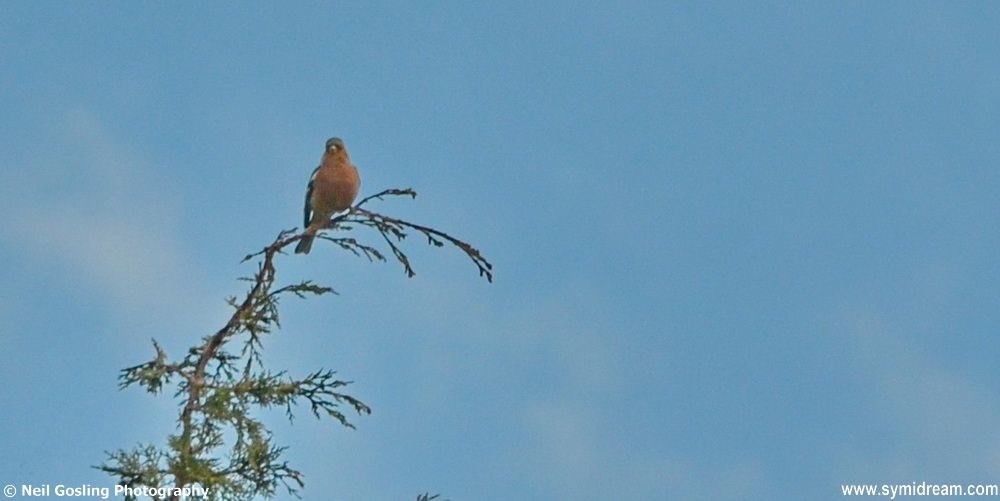
Local finch
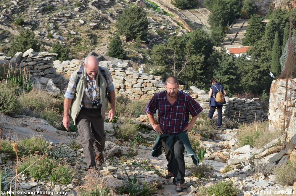
But still, enough about that, Saturday has dawned bright and clear, as if nothing had happened. Here are some photos from Neil taken last weekend. You can click to open them in the lightbox and then run a slideshow if you want. Have a good weekend and stay dry!
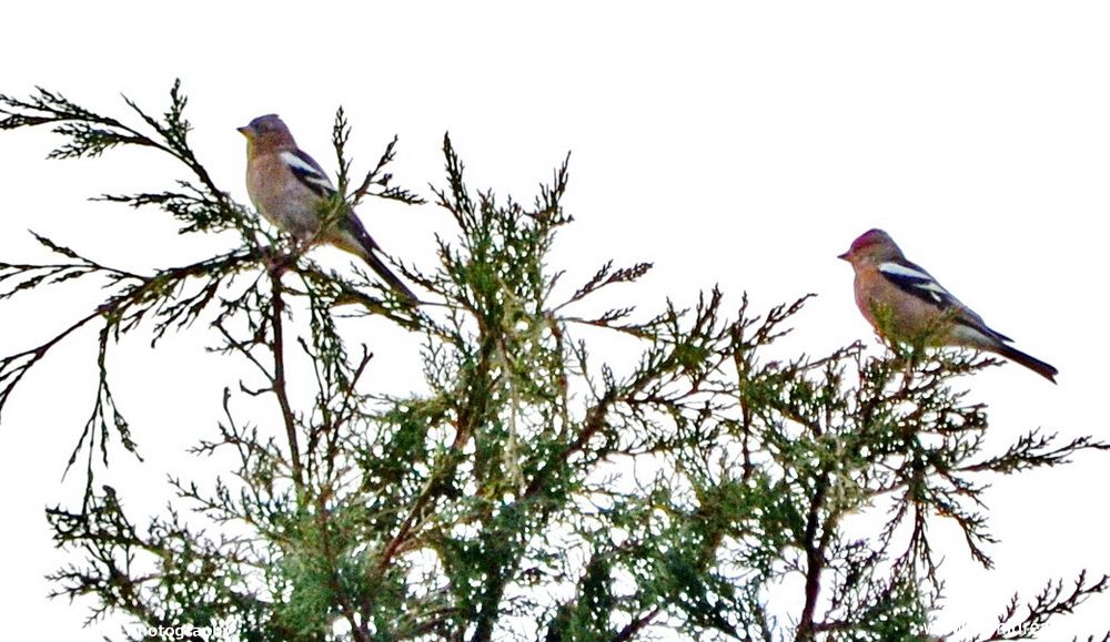
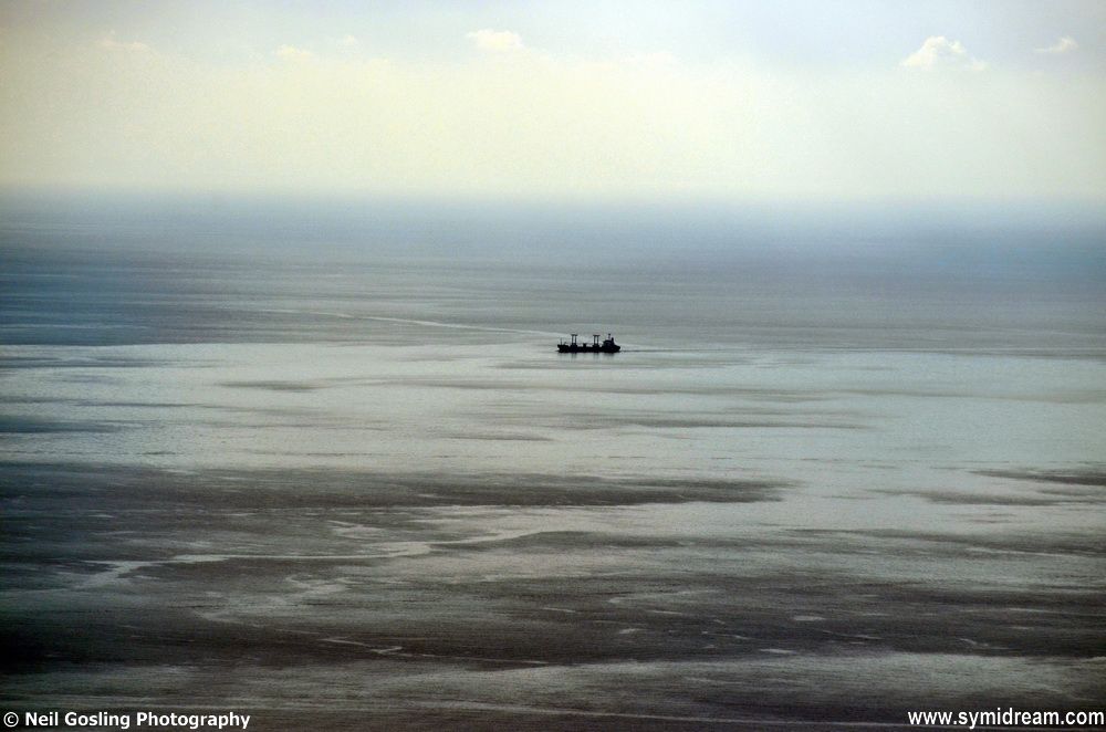
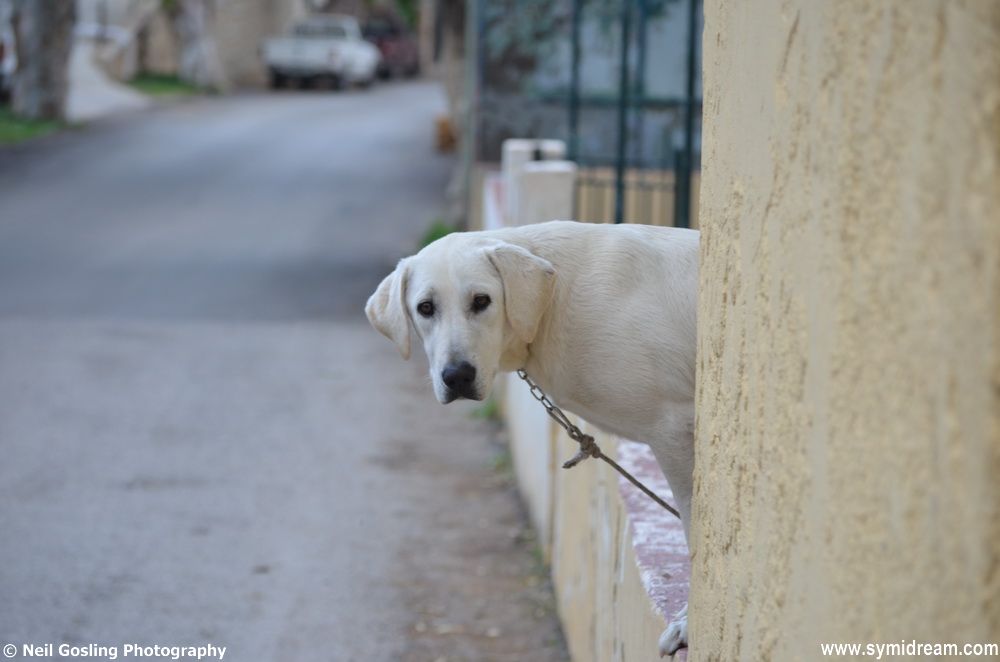
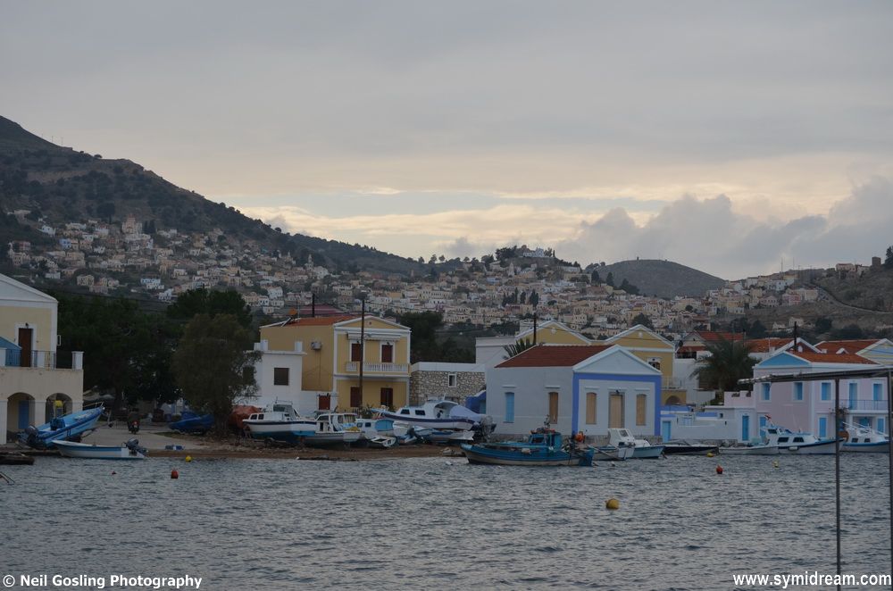
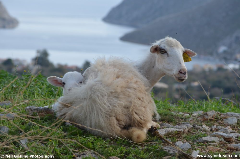
Local finchesLonely seasLonely dogQuiet PediLambing alreadyGoing for a short walk
The main road through Symi was only really opened up in the 80s and 90s. When I was first here, in 1996, I followed the tarmacked road from outside Lavinia Studios, where I was staying, and up the hill to see where it went. I followed it to the start of the forest about half way across the island and there it ran out, becoming a trail of rocks and stones, blasted out and ready to be flattened and tarmacked. I may be wrong (usual am) but it wasn’t actually finished until we came to live here in 2002, or it had only just been finished all the way, or something like that. Since then new roads have been laid (lain?) across the island to link distant homes and farms and even beaches to the main road. Still no traffic lights or roundabouts though.
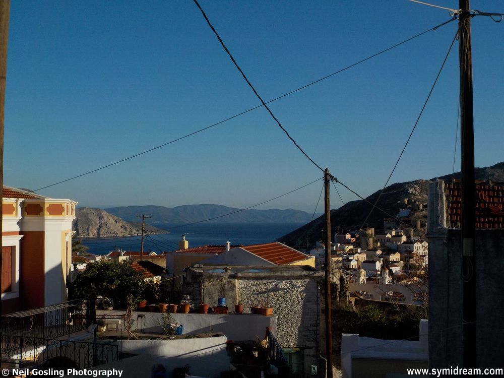
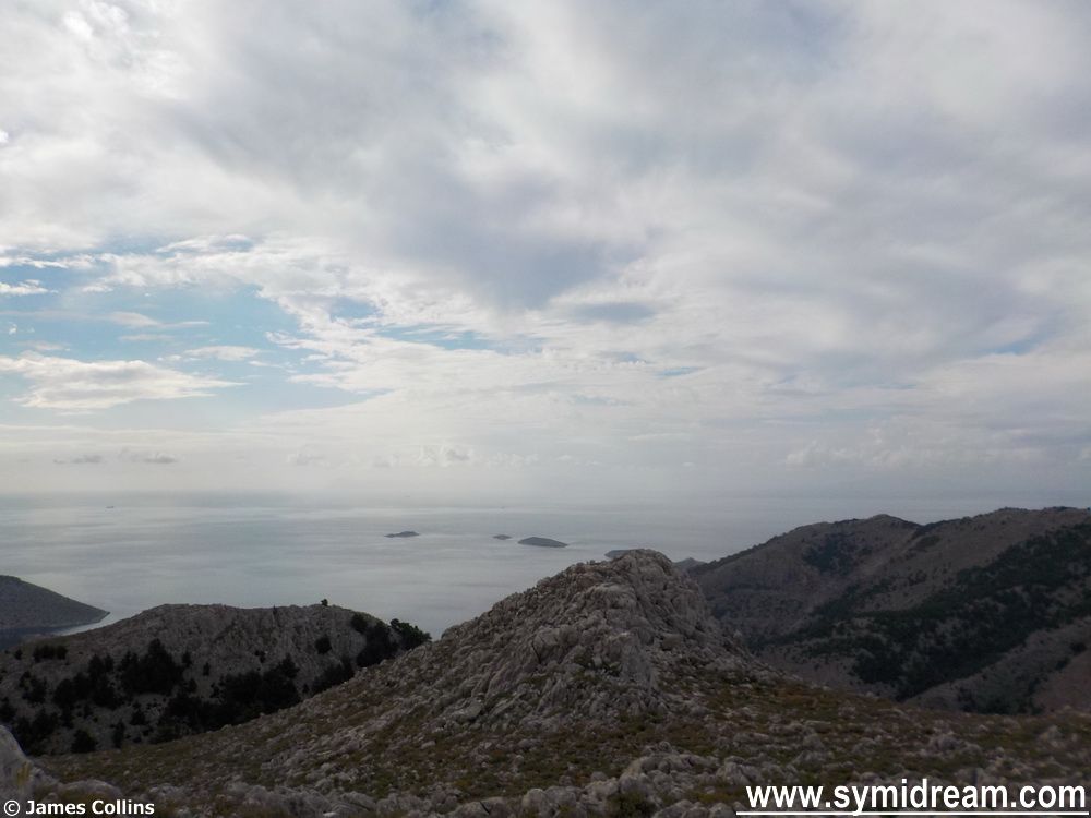
view towards Halki/Tilos etc
And we’re now walking on this road heading back towards Ag Konstantinos, past the now collapsed army outpost building where once upon a time soldiers used to stand guard, past their old shooting range and the old kalderimi, the original path from Yialos to Panormitis, or at least one of them. As we walk along we can follow the edge of this, though it disappears under the main road, the scree that’s been churched up from the road building, under piles of trash thrown over the hillside by lazy folk, old washing machines and stuff that the council has to come and clear away (woops there goes our council tax) and even under someone’s house on the edge of the main road.
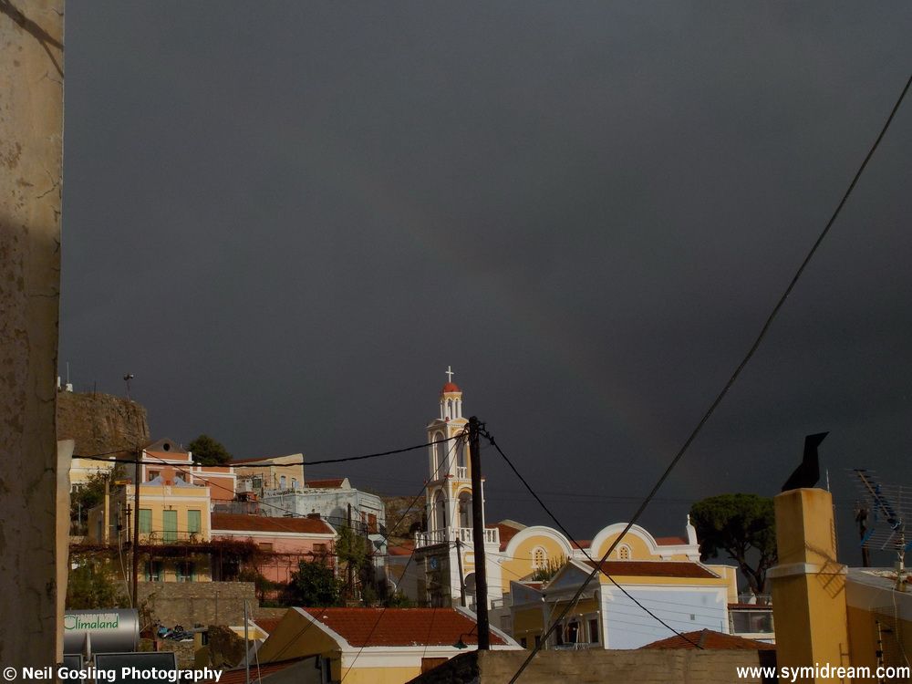
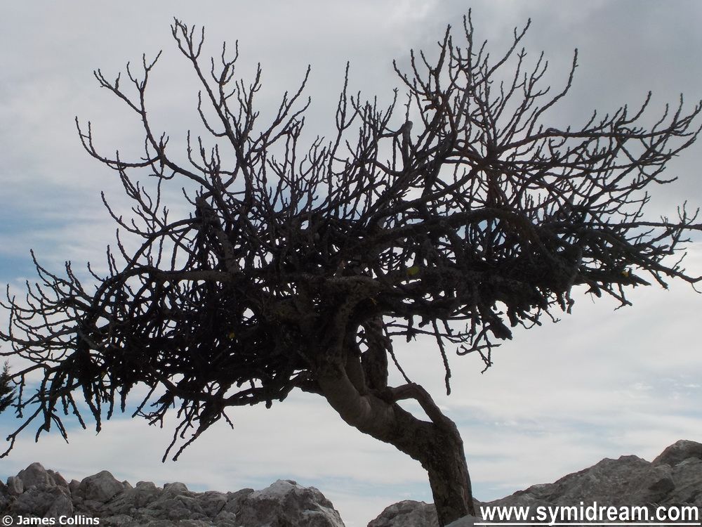
Symi skies
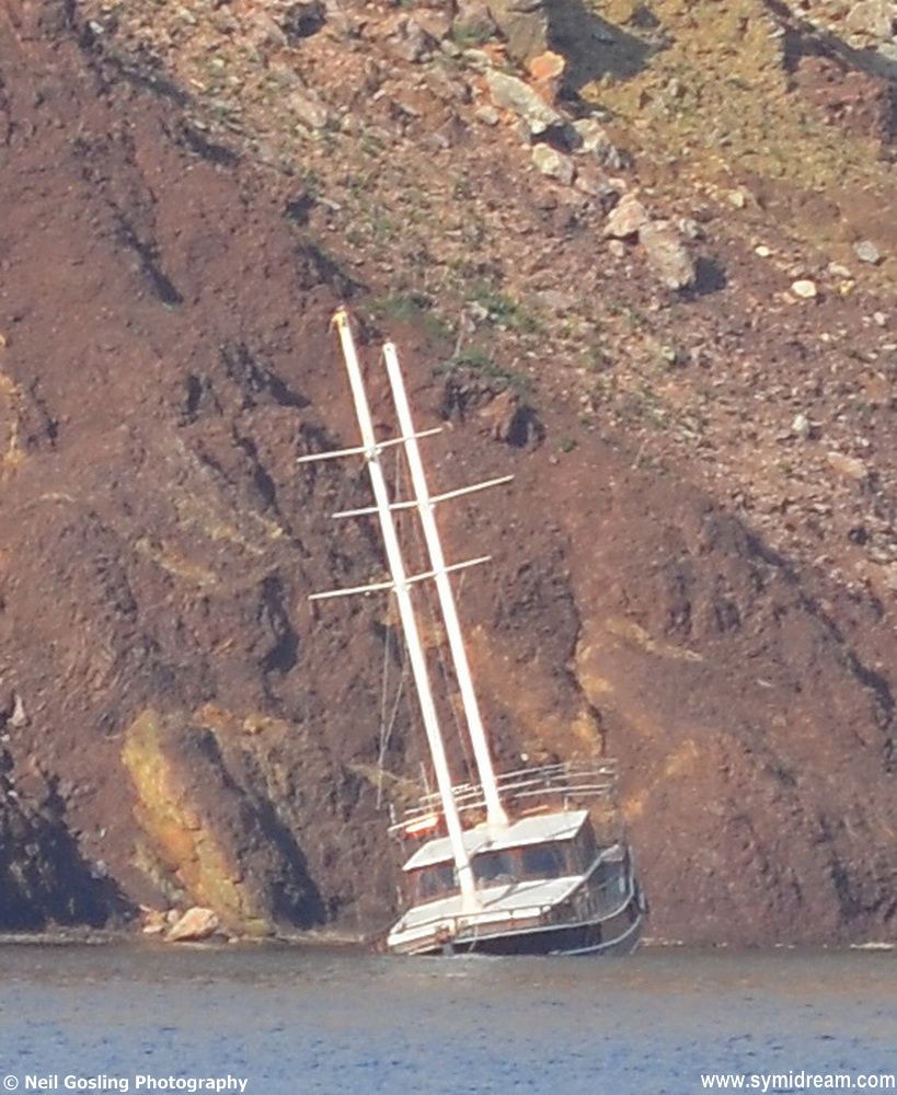
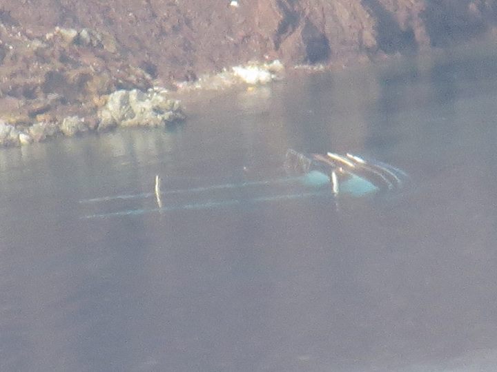
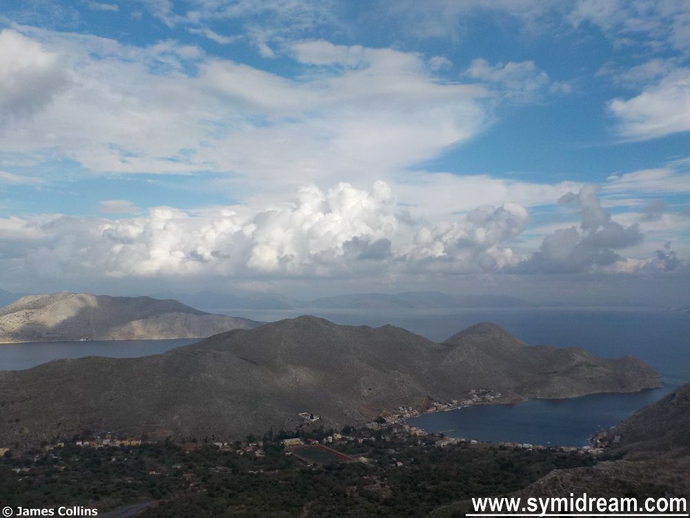
From up here we can see the island of Halki, which looked like it was being rained on, and Tilios and Nissyros and even the bottom end of Kos behind the Turkish peninsular. The clouds are still massing and passing, some grey, others white, a cloud-spotters dreamscape I imagine. And far off by the old fish farm the gullet that was used to illegally transport some refugees, and that was listing to port last week (if you read last week’s walk you will have seen the image), has now capsized and gone under. I guess the council or port police will have to try and do something about that, I am thinking they might like to get a team in to clear away any pollution (whoops there goes the rest of my council tax), but that may be my own kind of dreamscape.
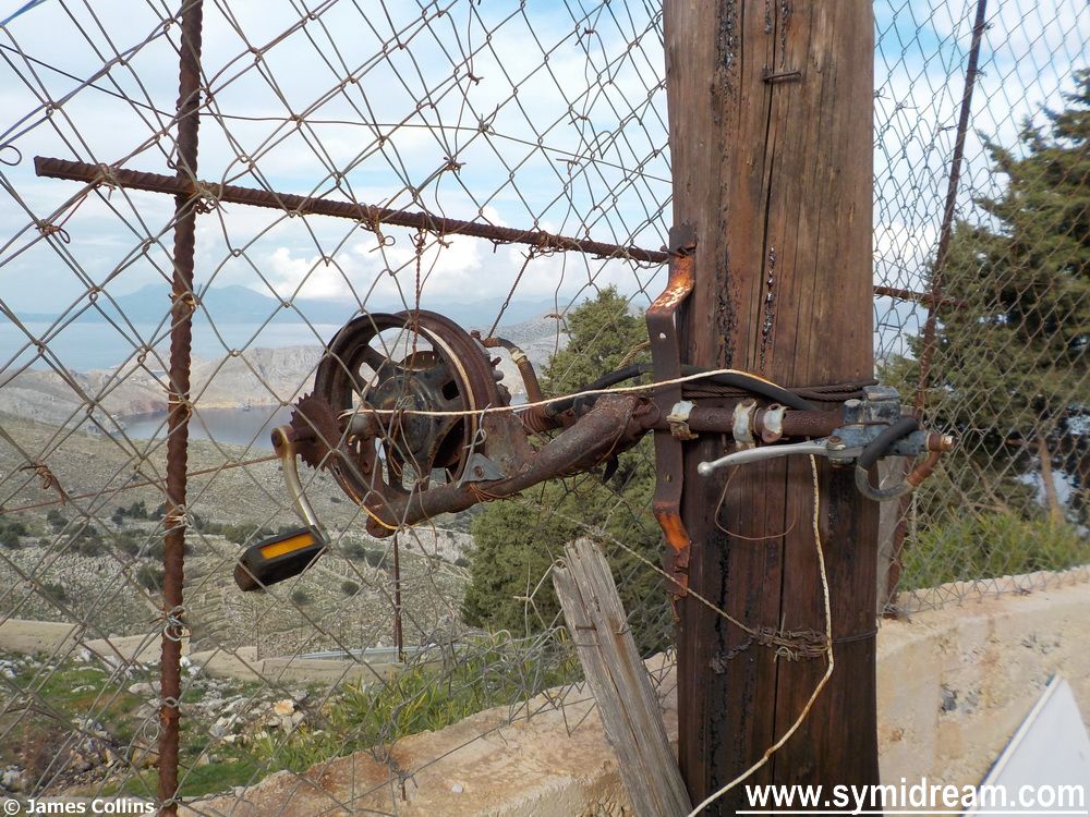
101 uses of a bicycle pedal
And onwards, the old kalderimi running out as we pass the fork for Ksisos/Panormitis, my feet finally starting to ache as we’ve been marching now for four hours, the tummy rumbling and someone in the party mentioning a glass of something at Mandeio’s on our return. This kind of spurs us on, as does the thought of the thing in the slow cooker that I rustled up this morning, making dinner an easy thing to organise when we get home.
Symi museum today
I have to pause at the house by the road to check out the contraption. I am not sure what it is, looks like a clothes line, or a way of getting things from road to house, but it’s an intriguing use of a bicycle pedal.
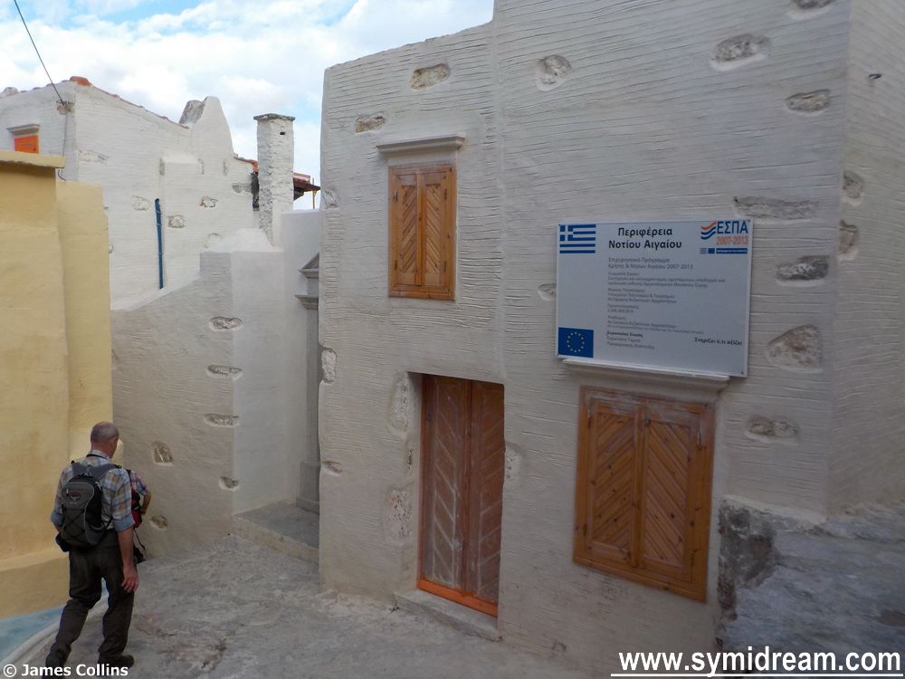
And we finally make it to Mandeio’s for a glass of red four and a half hours after leaving home, having done a circular route, and passed the museum where the external scaffolding has now come down at last. It looks like there’s still work going on inside and on the roof, but the outside walls and the shutters appear to have been fixed up.
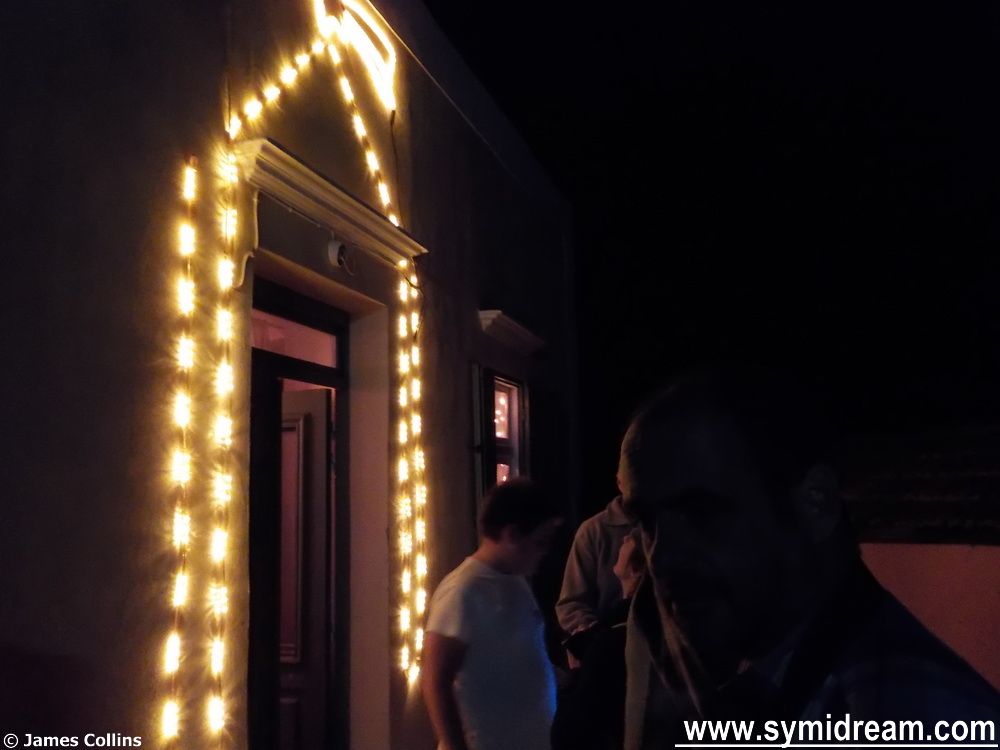
Christmas lights (a few of)
And so to home and dinner where our walking friends made a complete fuss of Jack, the Alarm Cat who, after an hour or so of being allowed to share his fur with anyone on the sofa, was quite overcome and, by the looks of it, took to the bottle. To round off the day (and remember we’re still talking about last Sunday) we went to the switching on of the Spalding illuminations, which was a fun event. Now I just need to head back up the hill to 400 metres and see if I can see the lights from up there and the betting is that I will be able to. But I am not going up there at night to check it out.
It’s all been too much for Jack
Scroll down for the boat I mentioned, before and after.
Getting that sinking feelingGot that sunk feeling! (Photo by Lyndon -thank you!)
Still Walking through the Χαμές area of Symi (part 3), still wandering the Symi hills last Sunday:
Following the road-come-track we pass a church dedicated to Agia Marina to our right and come out of the woods to an area with no specific name; it’s between Pervola on the west and Koupi on the east, and, from the centre of this area you can look south (towards Rhodes, roughly) and down into the Nanou valley. If you are looking at a map you can find us near the church of Ioannis Tsagrias where a threshing circle is marked, that is if you are on the same Symi Terrain Maps as me.
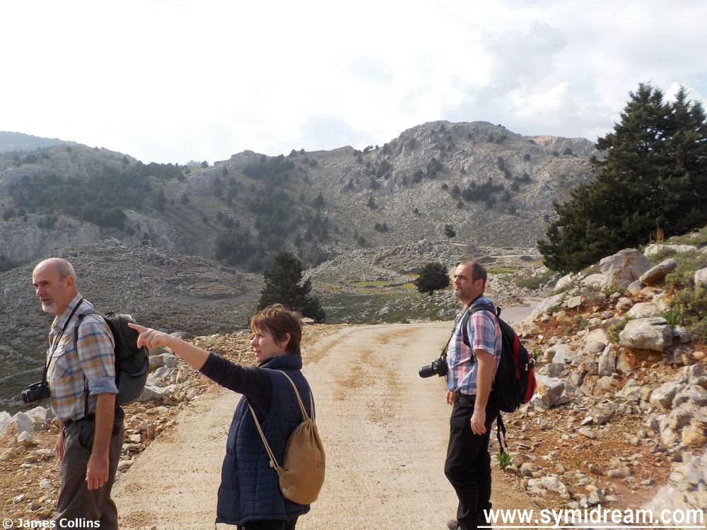
Yup, definitely that way…
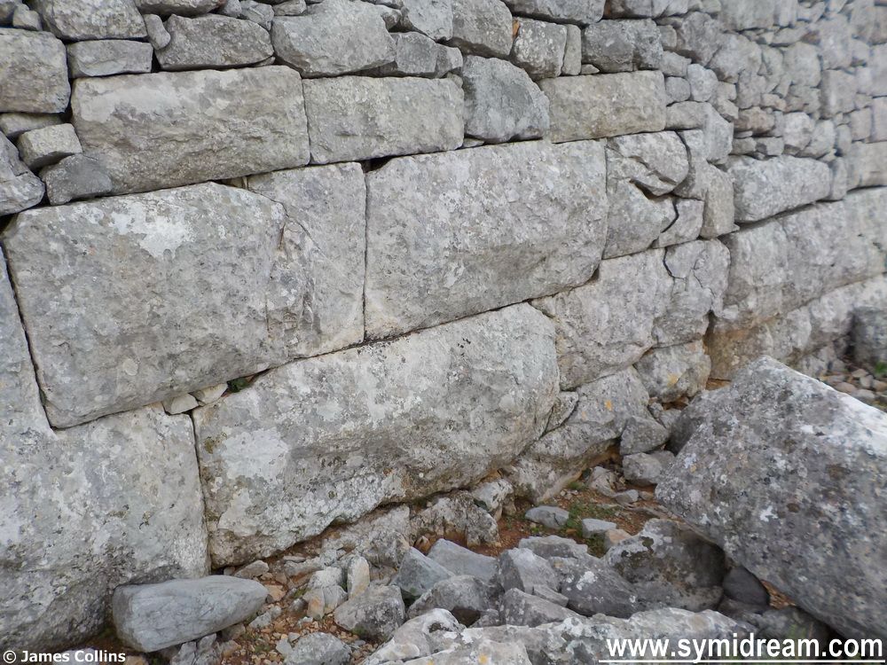
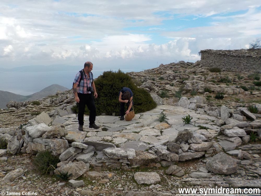
Anyhow, there is an ancient ruin hereabouts, which is a few metres from the path, or thereabouts, and this is where we find us four walkers, or layabouts. Actually, we’re not laying about we’re clambering about and examining the stones, many of which are dressed. Some of them are in the same design/formation as those at the bottom wall of the Castro, which we know from books to come from Byzantine times (330 to 1453 a.d.); closely cut together to fit neatly leaving no gaps and not requiring mortar.
That’s a view
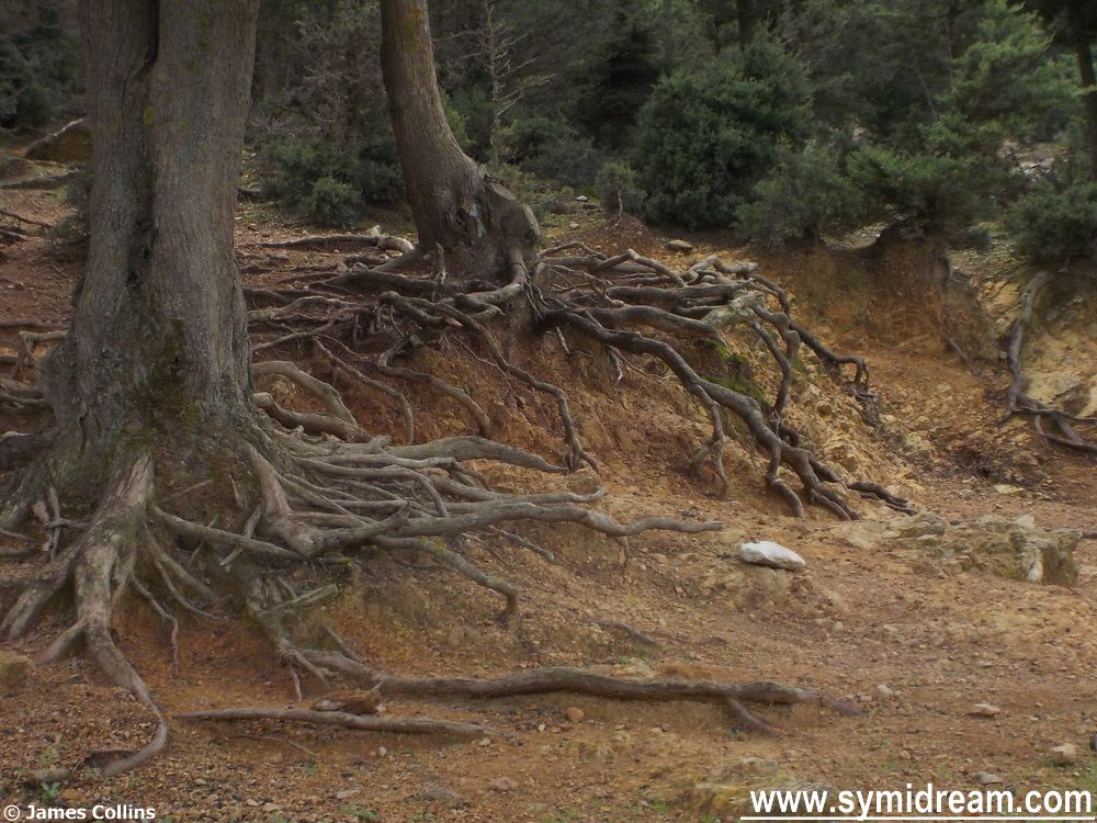
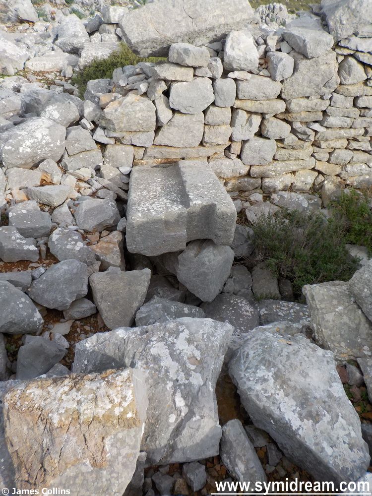
The stones are forming a wall on three sides of a natural hill, the fourth wall, facing south, is mainly made up of natural bedrock, sharp and rising to an apex. If there was a fourth wall there it’s long since gone. In nearby shepherd huts and once-were buildings you can clearly see some of these dressed and very large stones, so the site, whatever it was, has been robbed out.
Walls of the unmapped, unnamed ancient site
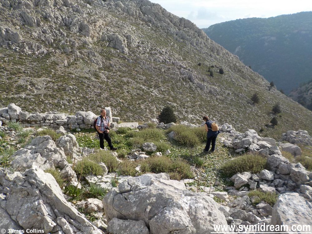
Within the walls there is a large stone circle which could have been a roundhouse, it could have been an animal enclosure or it could have been something else. I wondered what this place may have been. If agricultural, why go to the trouble of dressing so many large stones and building what would have looked like a fortification? I didn’t think it was a temple as it didn’t face east-west as you would expect, and it was more square in shape, rather than rectangular. So, I wondered if it had once been some kind of fortification or defence, or even an outpost or beacon.
Exploring the site
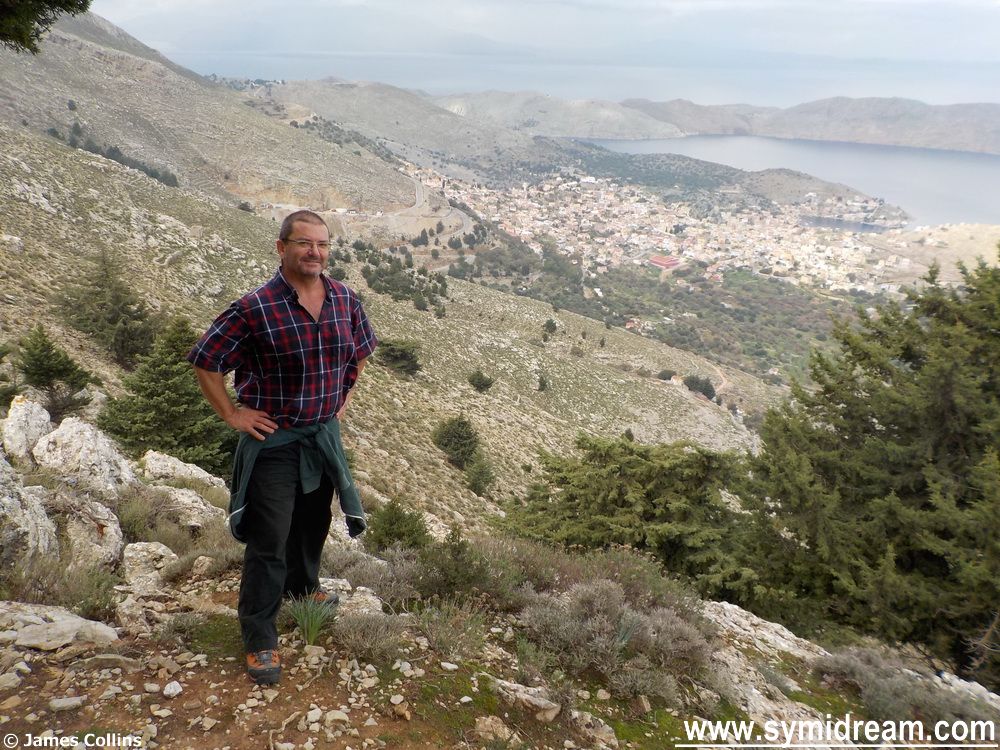
From the top of the centre, the rocky outcrop, you get a panoramic view from Nanou and beyond (you can just make out Rhodes), all the way around 360 degrees to the various hillsides. If anyone was going to come up the Nanou valley you would see them, if anyone was coming from Panormitis across country (before roads) you would see them, and you could easily light a beacon to warn anyone at the top of the mountain, who would then light another one to warn the town. Just a thought.
A door step with post holes and lip?
We had a great time carefully exploring the site, there are pottery shards there but they could be ‘recent’ and there are stones which were clearly, at one time, door steps with holes cut for posts and the like. But what this place actually was remains a mystery for me; perhaps someone will let me know at some point?
And so onwards towards home. This involves following the road and keeping the Vigla (the main mountain) to your right as you head towards the main road, which is where we shall pic things up tomorrow.
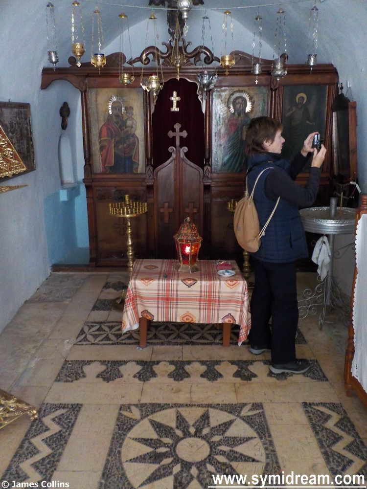
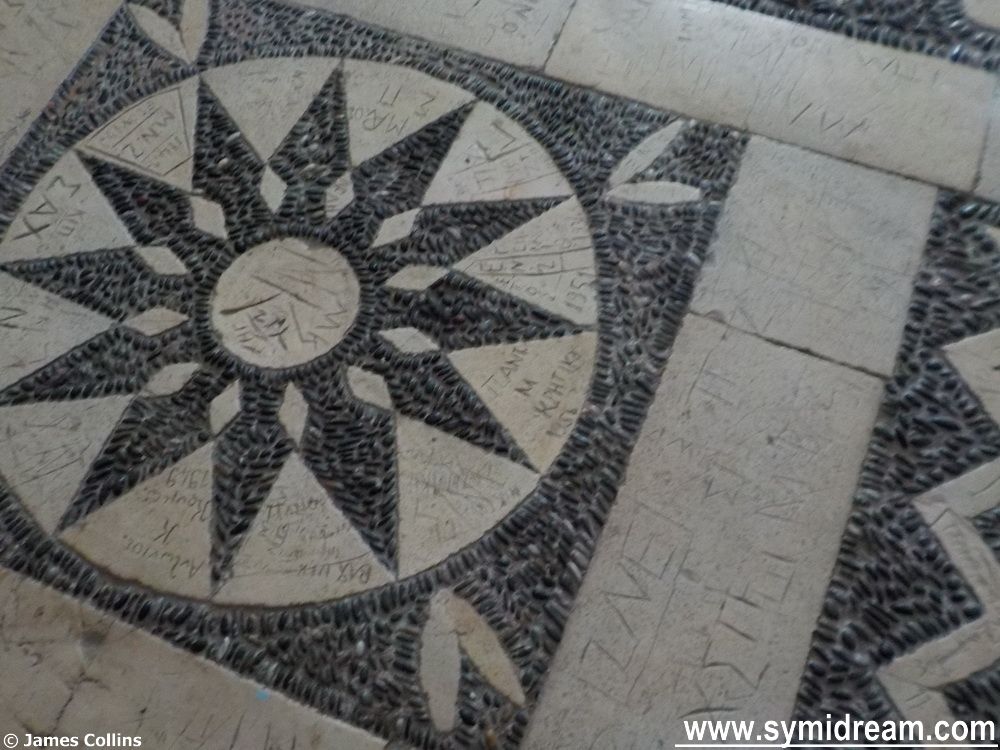
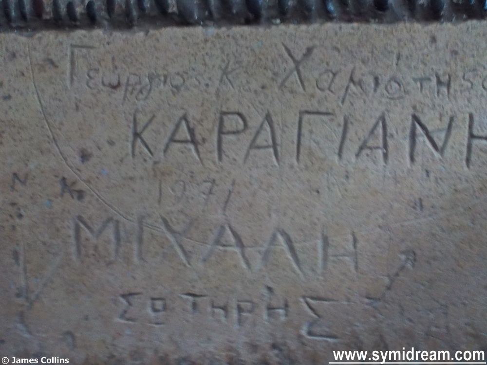
So here we are up at ‘Chamon’ and we’re taking a look around inside the chapel where the floor is pebbled in traditional local fashion. What’s not so traditional about this church is the graffiti in the floor, some of which dates back to the 1950s, maybe before. I saw dates in the 1970s as well.
Actually at the top, Neil and Justine examine a threshing circle
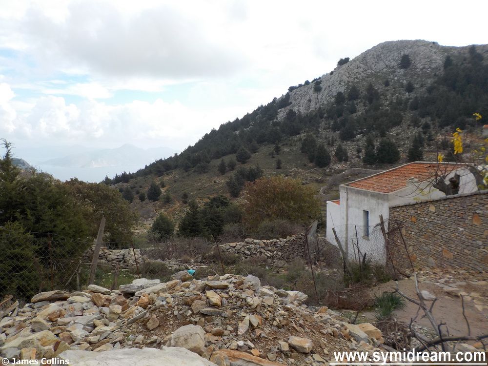
Besides the chapel is a house and there are people living up in this little settlement. It’s strange but I’d never been here before, well, not exactly here. We did, many years ago, once walk past the place but slightly further down. We’d walked from Horio around the road to Agios Efraim, and then turned off towards Kokkimides, wandered around towards Chamon and then headed across country and ridge to come out above Pedi, where we then traversed the hillside, heading down, following a donkey track to finally arrive back at Ag Marina cemetery again.
In side Panagia Chamon
This was a four hour walk and had started due to a ‘let’s go for a short walk after lunch’ conversation; we just carried on walking and I can remember the exact day. It was November 5th 2002, because after we returned home we went to Jenine’s house for fireworks; it was the first time we met Ian.
At Chamon
But that’s an aside. Back up at Chamon, the path becomes more made up, concreted in parts as it is used as a road by nearby farmsteads and homes, though there are few, and in other parts is just sand, washed away by recent rains and showing pits and holes and boulders. We stopped now and then to admire the wildlife, chaffinches, ravens and coal tits, apparently.
The chapel floor
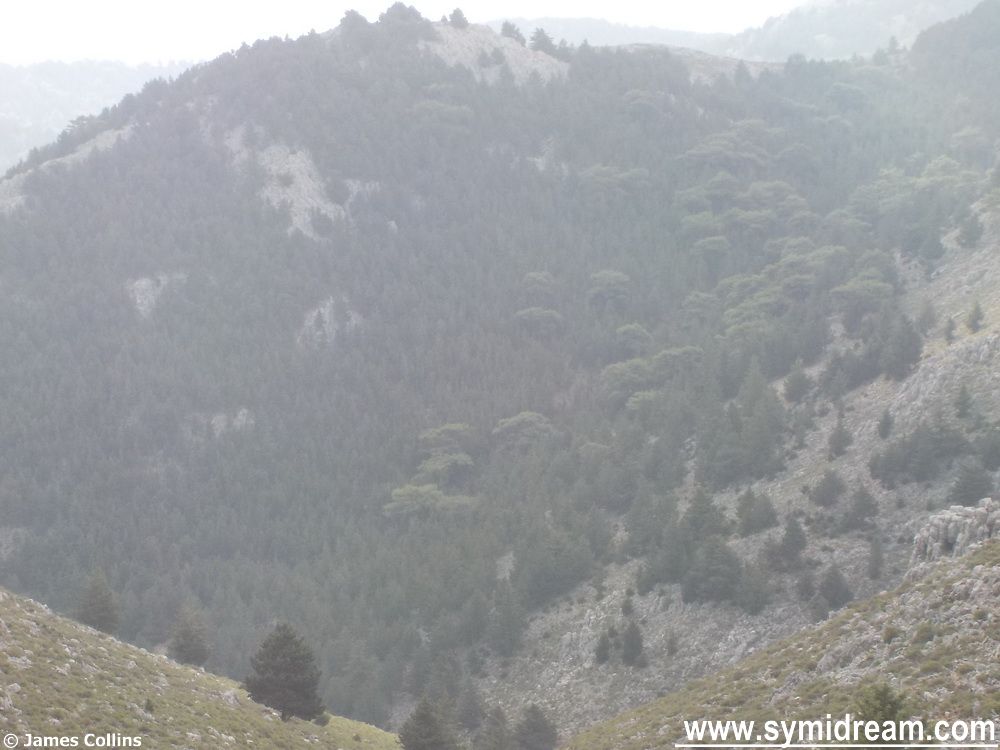
It’s a beautiful place up there, with trees on the further hillside, and on this side of the valley, views across and up to Kokkimides, and towards the sea (not that you can see it) and the cliffs above St George. Peaceful, warm in the sun when it appeared through the clouds and with nothing but fresh air scented with herbs.
In more detail
We haven’t come very far today, tomorrow’s post will be a bit longer as we get into some archaeology (i.e. guesswork on my part) and have a look around an ancient mystery. Meanwhile, in real time on Symi, we’ve been having more grey skies, storms, rain, winds, but some warm weather, and there’s no great news to report.
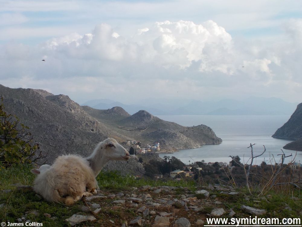
Sheep with lamb hiding behind – very early for lambs isn’t it?
Today we start a walk from Horio to Horio, via the top of the hill, a ridge, some ancient sites, a church and a road, among other things. The area we’re walking towards, at the start of the walk, is called Χαμές, or Hames, of Chames on some maps depending on how you want to translate the Greek letter X. It’s pronounced kind of like the ‘ch’ in the Scots word ‘loch’, unless it comes before and i or an e in which case it’s pronounced as the h in ‘hew’, so in this case it’s more correctly ‘Chames’ though not as if the ch came from ‘church.’ Try saying ‘loch-ames’ without the lo, and pronouncing the ‘ames’ not as in ‘James’ but as in two syllables so: ‘loch-am-es’ and with the accent on the ‘es- part. Got it? Good, now you know where we are going.
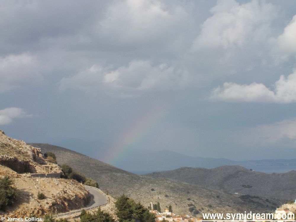
Rainbow over the sea
By the way, I don’t know exactly what Χαμές means, it’s not a word in my dictionary, but the closest I can come to is χάμω, an adverb meaning ‘to, or on, the ground,’ and χαμένος, the adjective ‘lost’ or ‘the loser’ (as at cards, which is what we were on Saturday night before this tale starts). Being Greek, the word also means: break off, spend (money), wear out, reduce quality of, pull down (building), undo, change, seduce, kick up a row, move heaven and earth, deteriorate, spoil, go bad, get out of order, lose one’s looks. And if you add a slightly different ending you get, ‘there is a great to-do’, and also, ‘things are not so serious.’ All of which sound a bit like today’s blog, and possibly none of which have anything to do with the place we are going to so let’s get walking before we reach the end of the post.
Pit stop on the way up the hill
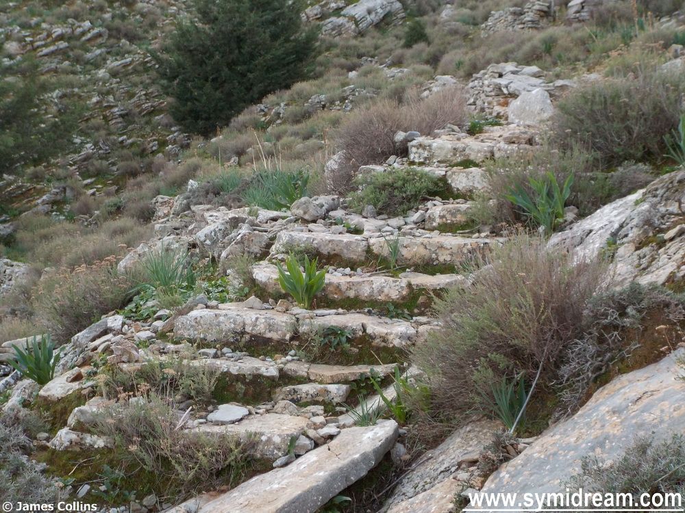
So, we started from home, a very good place to start, and wandered through the village and up to Ag Marina cemetery where we turned a sharp right, just through the gates and past the noisy dog. Upwards is the way to go when climbing up a hill and we certainly went upwards, in fact we climbed to the ridge which, on my map, is at 400 metres, 1,312 feet. This is rough terrain, mainly with a narrow path made by walkers and goats, but occasionally with man-made steps. Not the kind of steps we see in the village or on the Kali Strata, but a few ‘here and there’ steps, suddenly appearing in the middle of nowhere; it makes you wonder what they are doing there – the answer becomes apparent later.
Steps that appear in the middle of nowhere
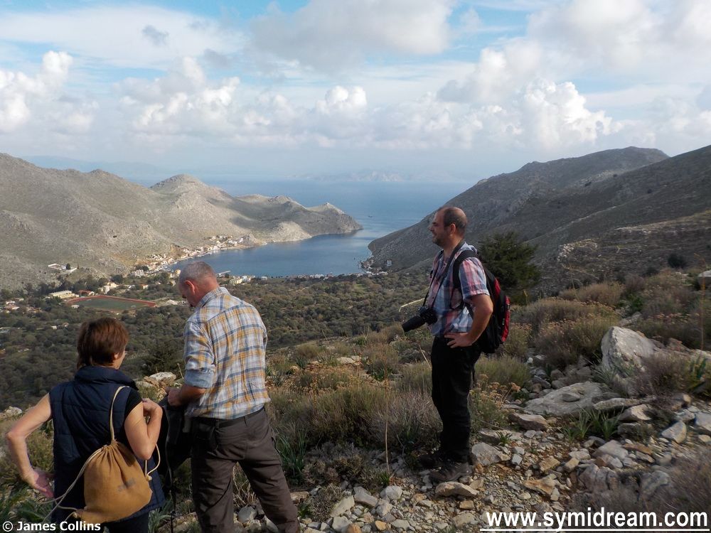
There are great views from up here as you might see in some of the photos. There was also a great skyscape with all manner of clouds, some threatening rain (which we didn’t get until after dark, by which time we were home) and there was a rainbow over the sea between us and Turkey. We stopped every now and then to take photos and swig from our water bottles, and then carried on. You can follow the red and blue dots or the not-always-obvious path and find your own way up here when next on Symi, but make sure you wear the right shoes.
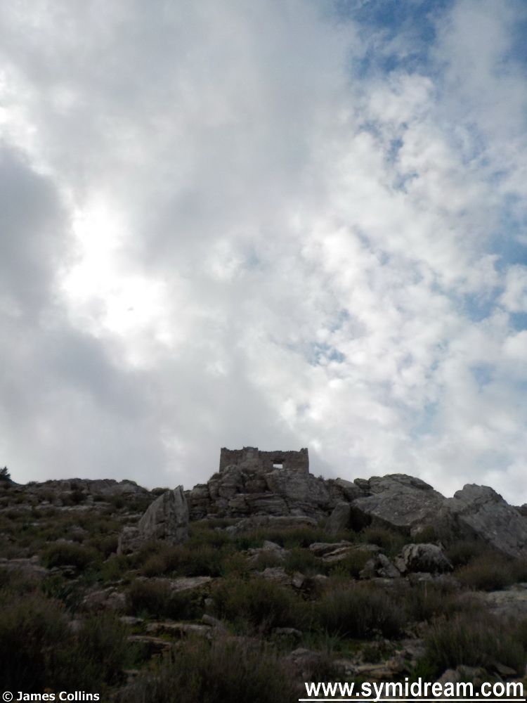
And a high-up disused hut
At the top, at 400 meters, you meet a threshing circle and a large area of once agricultural land. There are a few houses up here and a couple of chapels, one of which is called ‘Panagia Chamon’ (Χαμών), and that form of the word is the possessive plural, so, with ‘Panagia’ being the Virgin Mary, the church is ‘The Virgin Mary of the lost’ (perhaps), or ‘of the losers’ (maybe), or ‘of those who have lost their looks’ (more likely in my case), if it means any of those things at all, and I am sure someone who knows will put me right at some point. But the amount of habitation, stones walls, and evidence of once-well-farmed land now makes sense of those steps heading down to the village. If you were talking your goods to sell or put on ships, you’d come down the way we just came up, you wouldn’t go around the Vigla.
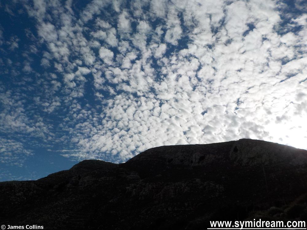
Skyscape
Okay, that’s got us started on the walk, tomorrow we will carry on but I wanted to leave you today with another ‘Sounds of Symi’ video. This is the sound of the village church bells ringing on a Sunday, for a name day or festival, or perhaps because we are in Advent, as heard from the side of the hill at roughly 300 meters up. (Sorry about the crunches from the camera.) You may need to turn your volume up.