Holiday Day 14 (March 15th) Last day aboard.
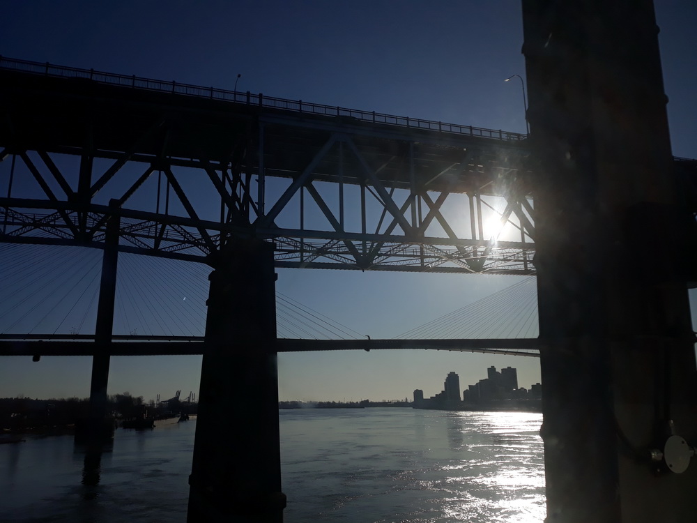
Kamloops to Vancouver via bridges, tunnels and views
The problem I have with this post is deciding which photos to show you. Between us, we have over 350 shots from the day, plus videos (which I can’t upload here for some reason), and many of them are similar, but all of them are worth seeing, in my humble… So, I’ve tried to cut them down. They take us from Kamloops to Vancouver, through part of the Rockies and into Vancouver where, I think, we arrived about 18 hours behind schedule.
We did miss a couple of things because of our delays. One, we missed the eastern side of the Rockies because we passed through in darkness, and two, we missed a quick bus tour around Vancouver which should have happened on arrival. We did it the next day instead, and that was just fine.
For this, the 14th day of our holiday, we were travelling from Jasper to Vancouver. According to the maps, that’s roughly 500 miles by road (which takes you through a place called Clearwater, which has meaning for me, as you’ll know if you’ve read my other blog), and, by road, would take between eight and 12 hours depending on the route. By foot, if you were crazy enough, it would take you 174 hours or just over a week, and by train, according to Google’s directions, one day and nine hours. We left Jasper at midnight and arrived in Vancouver about 20 hours later, the last few miles taking at least four of them, but I am getting ahead of myself.
Jasper to Kamloops
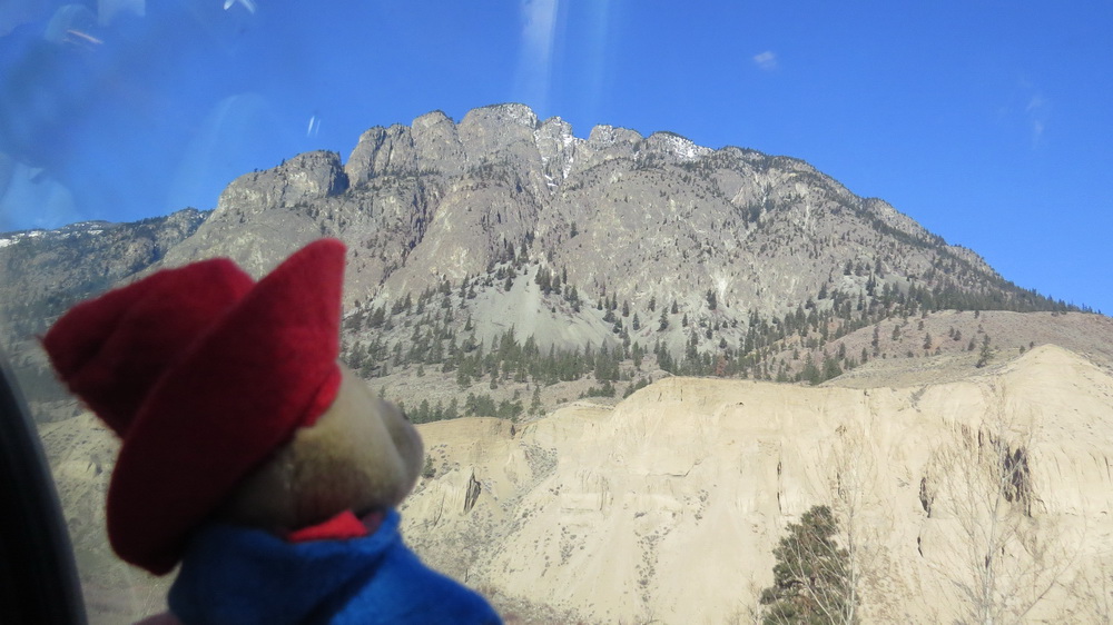
Here’s one of those photos that doesn’t seem to fit anywhere else but which I think is worth seeing. You can guess what it’s of…
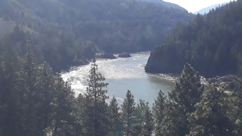
There were signs of approaching civilisation through the morning too. (It’s steam, not smoke.)
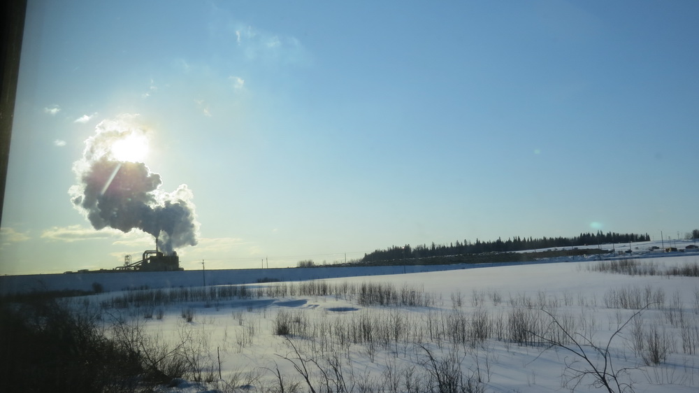
I’m trying to follow the railway line on Google maps to see what we missed during the night from Jasper to Kamloops. As long as I’ve got this right, we paralleled the Yellowhead Highway towards the west, crossed the border into British Columbia at Yellowhead Pass, and followed the shore of Lake Yellowhead, keeping close to the Fraser River. Later, still mirroring the route of the Yellowhead Highway [a 1,777 mile-long interprovincial road from Winnipeg to Graham Island, built in 1970], we passed Moose Lake, Red Pass (where we crossed the river) and Mount Robinson. Staying low, beneath the foothills of Klapperhorn Mountain, we passed through forests while the highway cut through the hills above and across the river, looped back on ourselves at Tete Jaune Cache, keeping to the contour of the land, and continued south towards Valemount. Here, as I squint into my screen to follow the line on the map, I notice we are running alongside Whiskey Fill Road, which I rather approve of, and on past Clearwater, Little Fort, McLure, and sometime around dawn, Vinsulla, finally arriving at Kamloops as the sun came up.
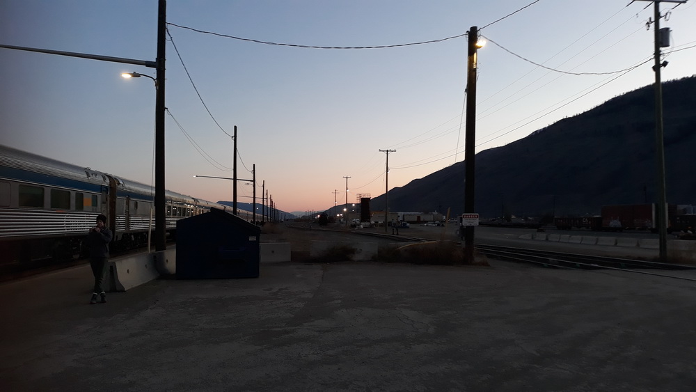
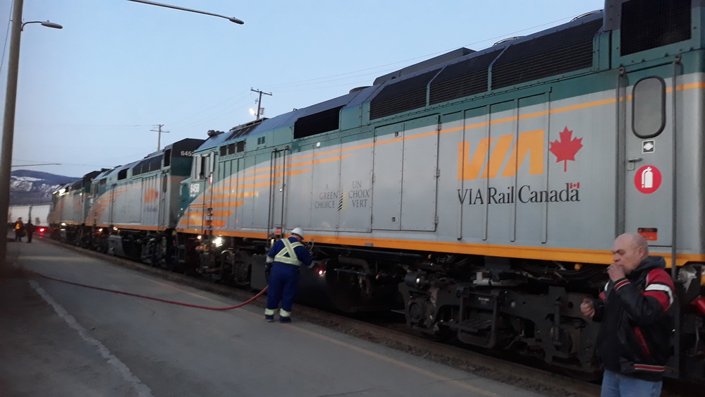
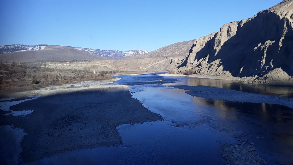
Early morning and Kamloops
It’s that breakfast cereal pace again, Kamloops. [The first European explorers arrived here in 1811. “Kamloops” is the anglicised version of the Shuswap word “Tk’əmlúps”, meaning “meeting of the waters”. Kamloops is in the Thompson Valley and the Montane Cordillera Ecozone. The city’s centre is in the valley near the confluence of the Thompson River’s north and south branches. Suburbs stretch for more than a dozen kilometres along the north and south branches, as well as to the steep hillsides along the south portion of the city and lower northeast hillsides.]
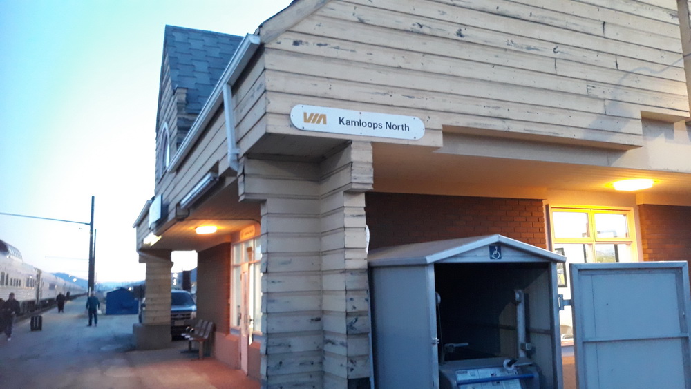
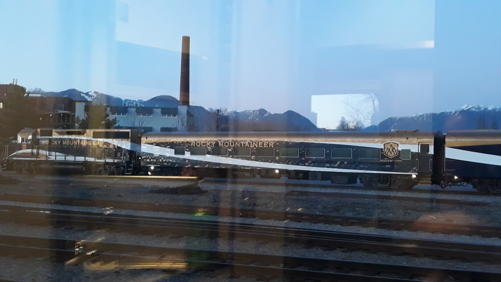
We saw the north railway station where there were a few minutes to stretch legs and admire the refuelling.
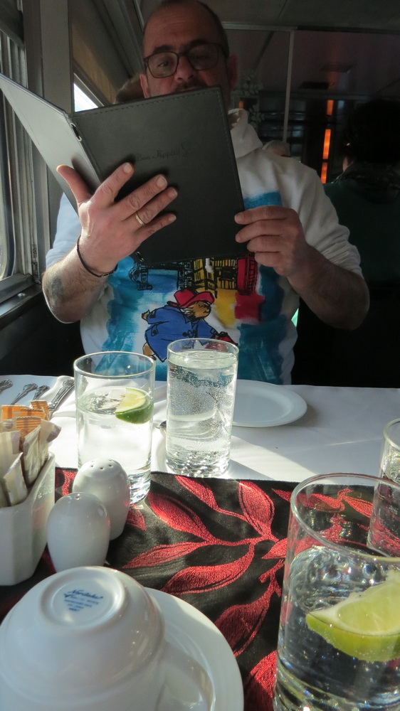
After that bracing time on land, it was time for breakfast, and here, Neil is either giving a sermon, about to sing a hymn, or choosing between the intercontinental, the healthy or the daily special. Either way, it was our last breakfast aboard and just as good as every other day.
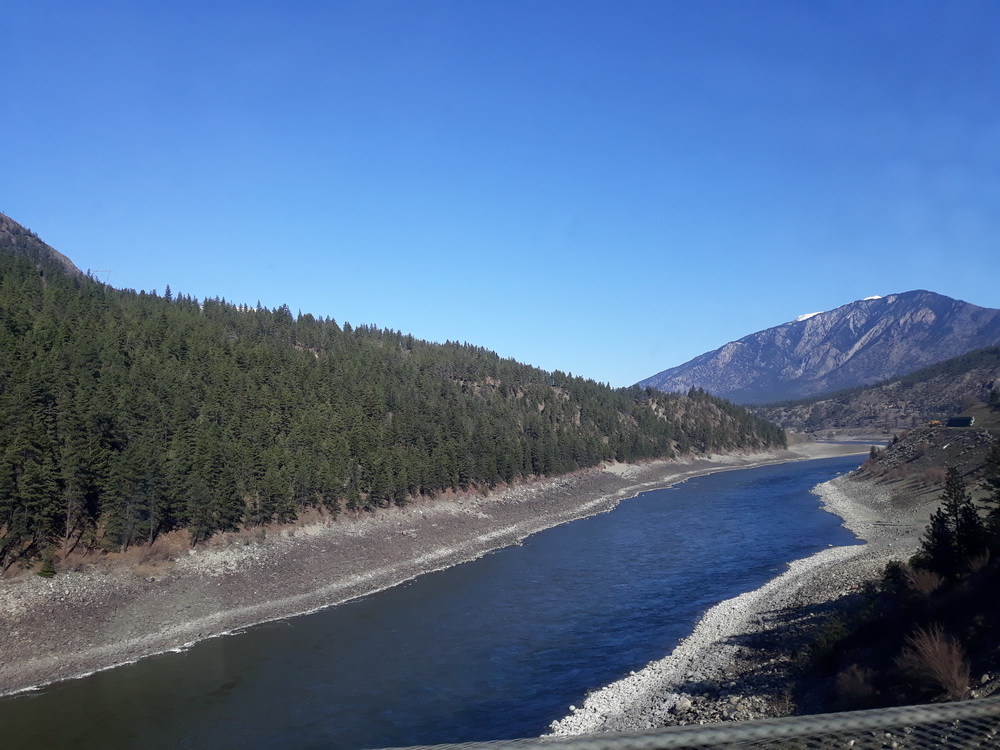
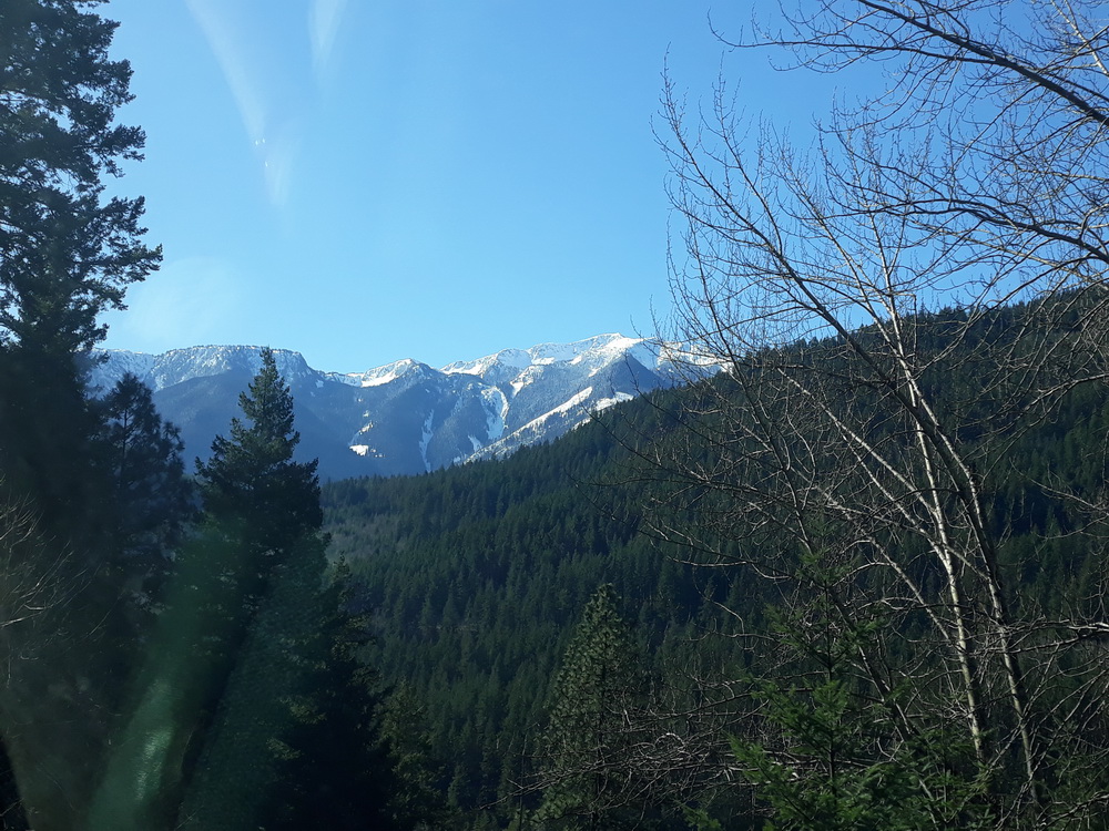
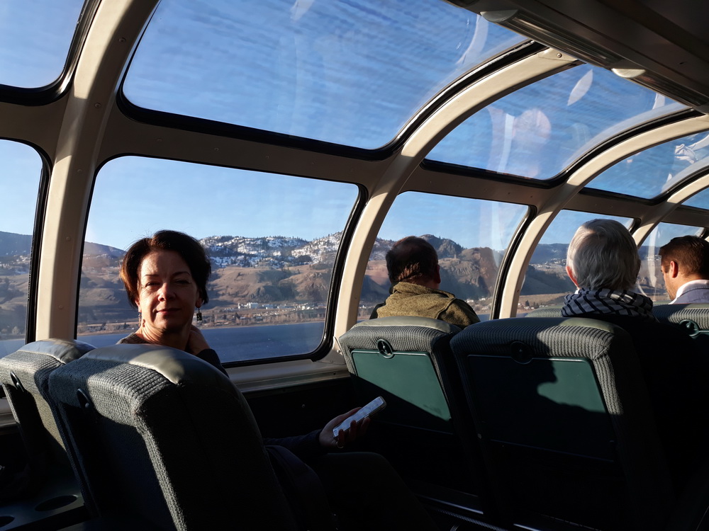
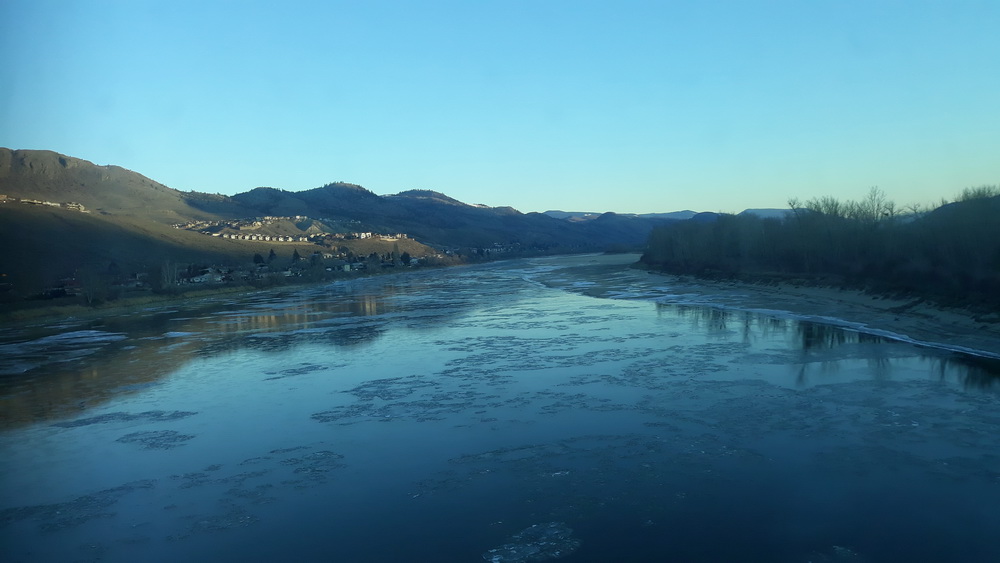
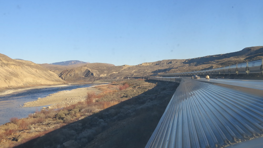
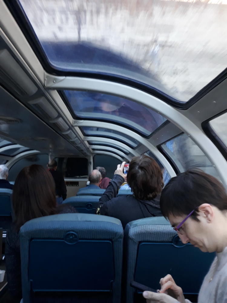
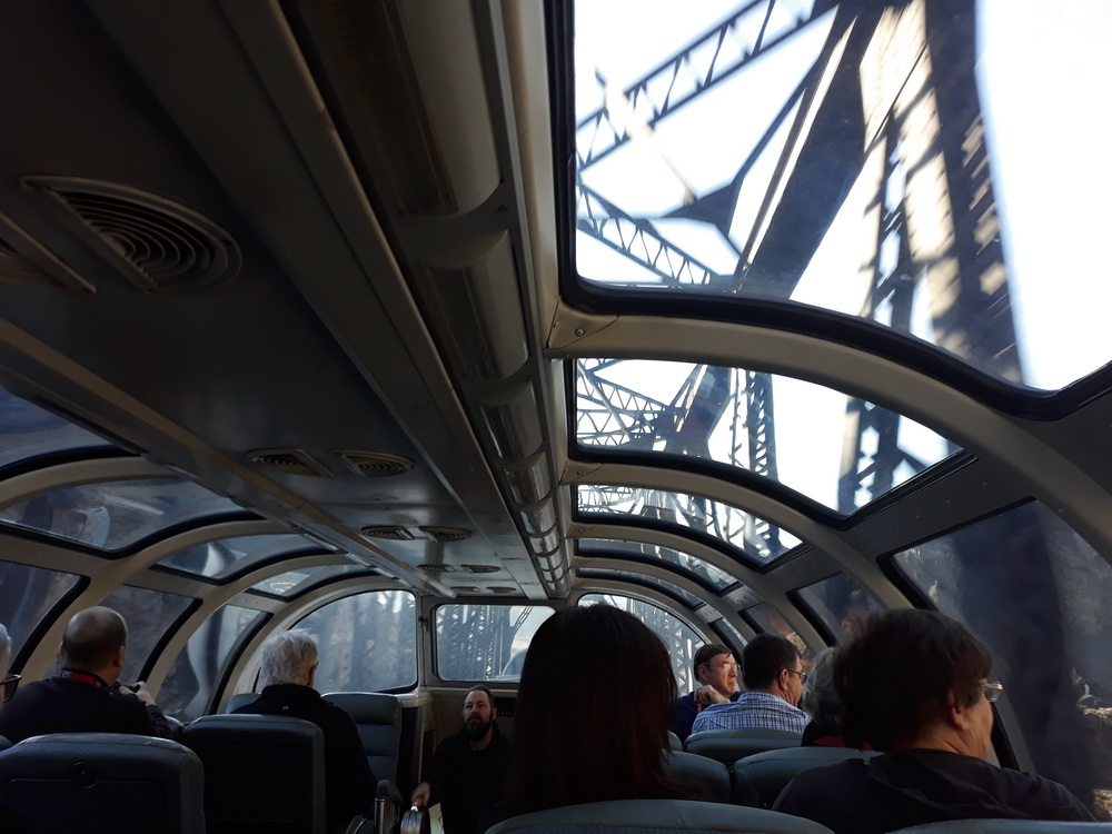
Most of the day was spent in the observation car, gazing out at distant mountains, rivers, bridges, cliffs and the occasional settlement. There was definitely more of a buzz in the obs-car that day, plenty of oohing and ah-ing, pointing, cameras clicking, videos whirring and the occasional cry of ‘bald eagle!’ at which time Neil would turn and say, ‘Yes, did you want me?’
Onward from Kamloops
I’ve just spent half an hour trying to discover the route we took next, but the Google map doggedly only shows me the road route. The timetables I’ve found say ‘restricted service due to Covid-19’, and little else, while others simply state that you leave Kamloops at X and arrive at Vancouver at Y. Presumably, they don’t mention points of interest because you don’t stop anywhere, so I’ll have to follow the road and hope the train did too.
Whatever. We may have passed the Cosco Wholesale at Dufferin… (Do you like Dufferin’? I don’t know, I’ve never duffered) and on to Rush Lake and Timber Lake and to… Ah-ha! I’ve found the railway line. I know this because there’s a thing on the map that says, ‘Inks Lake Brake Check – try saying that at speed – and if I zoom right in, I can see the tracks.
I wonder if this was Timber Lake? It would make sense.
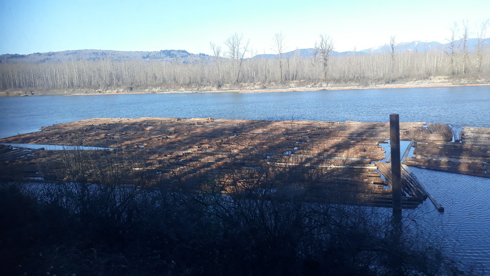
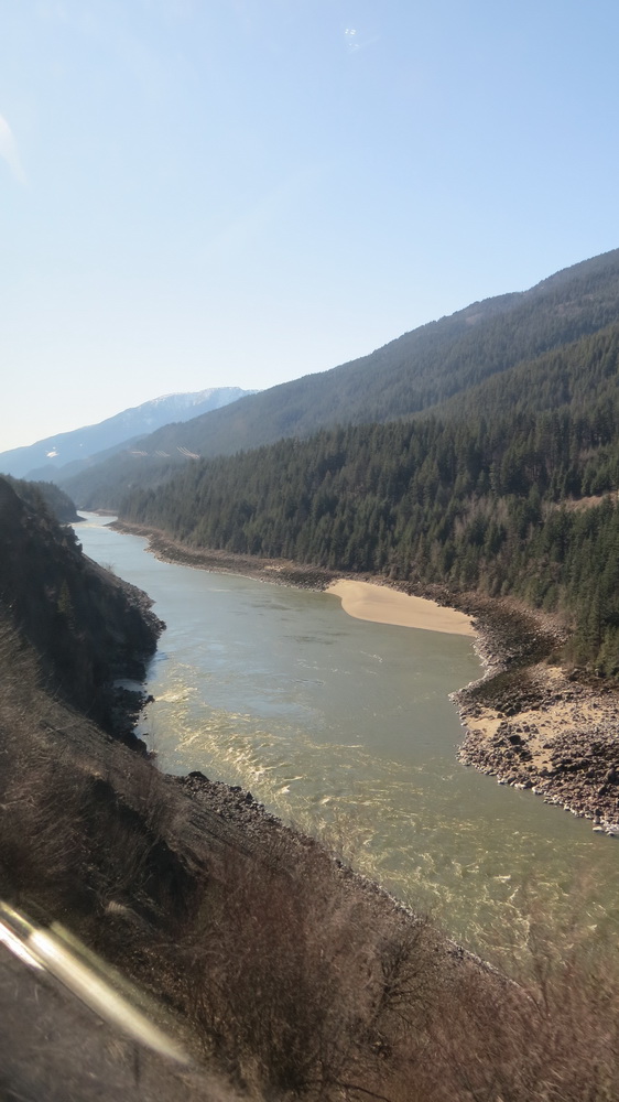
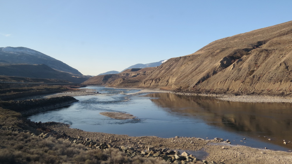
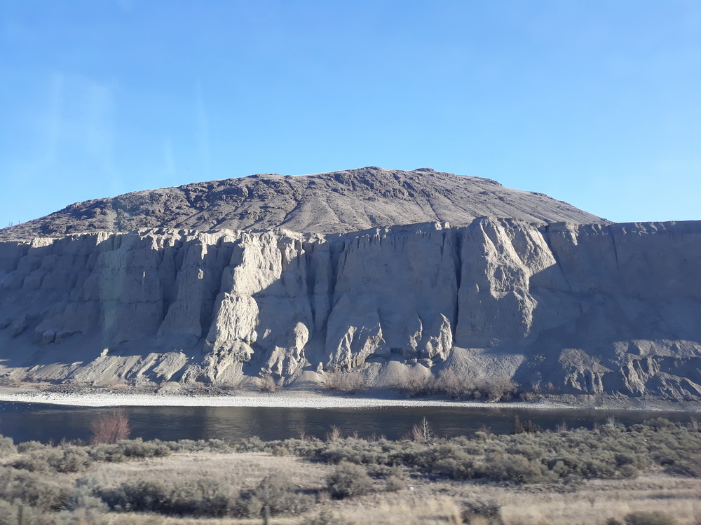
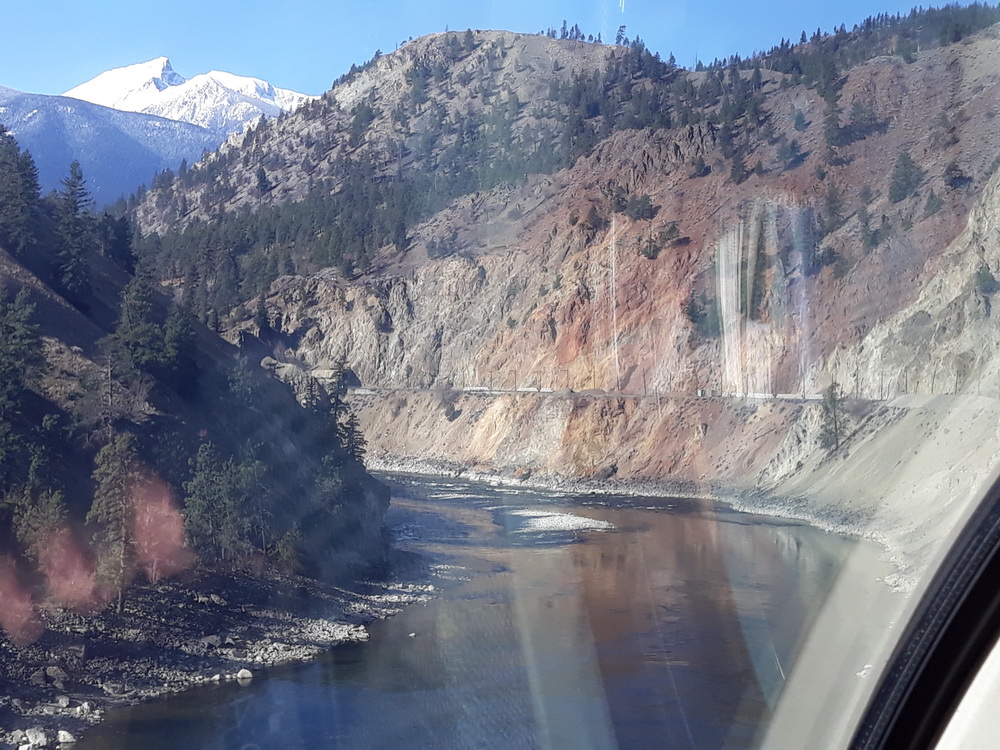
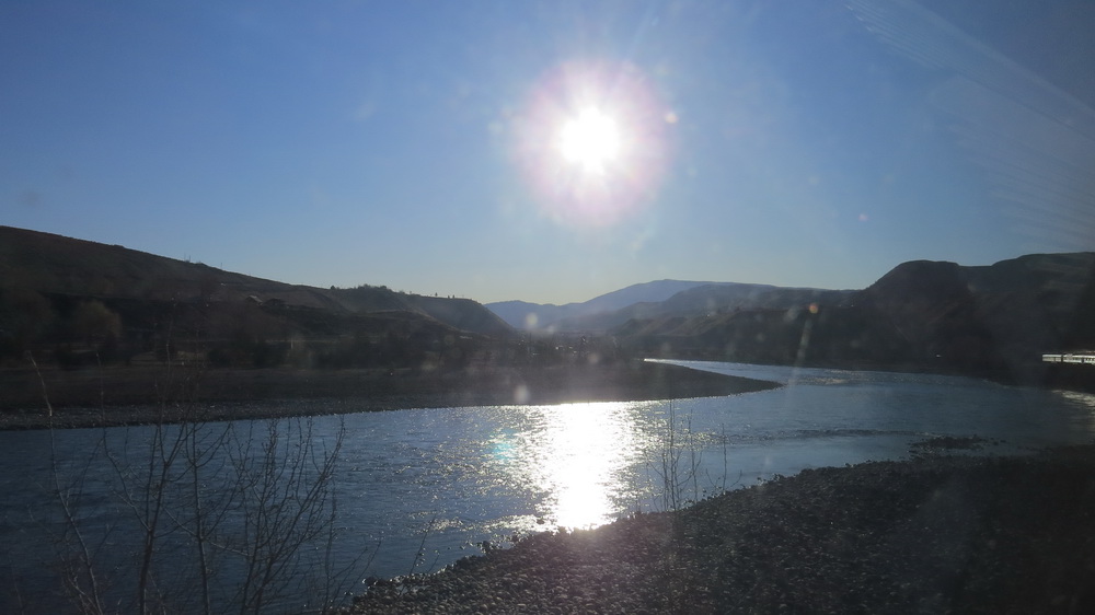
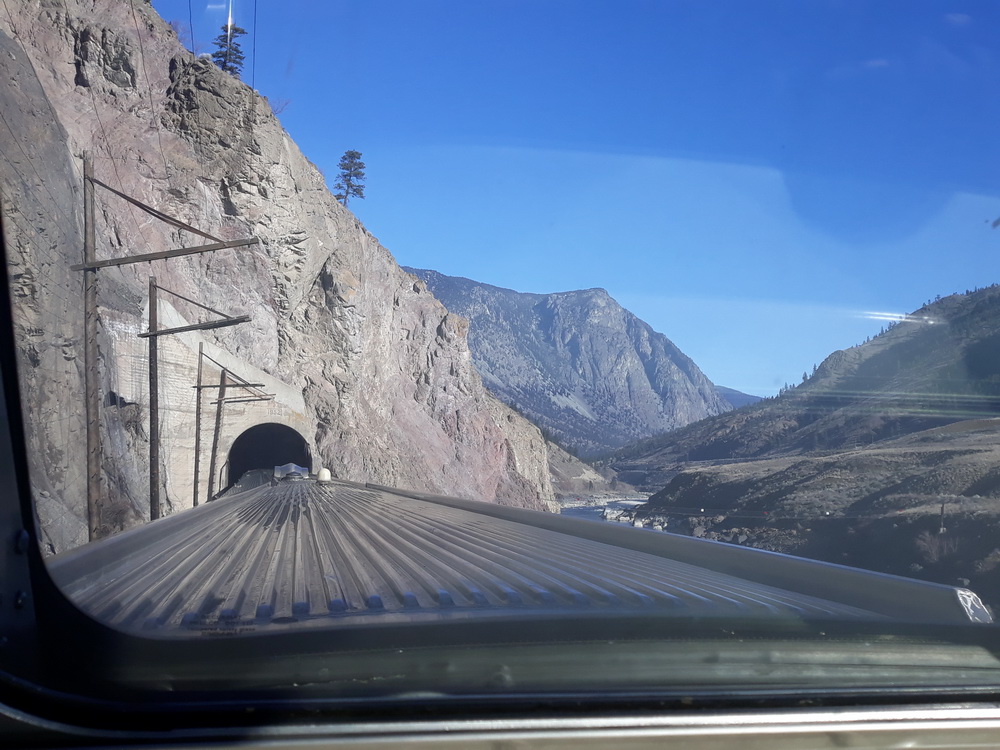
Anyway, wherever we were, there were plenty of river views…
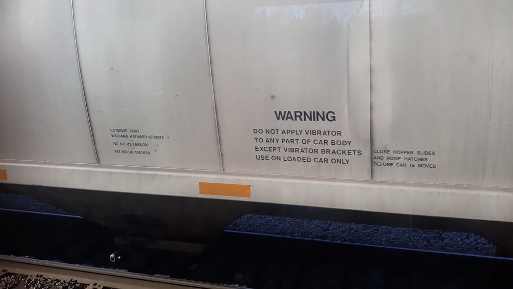
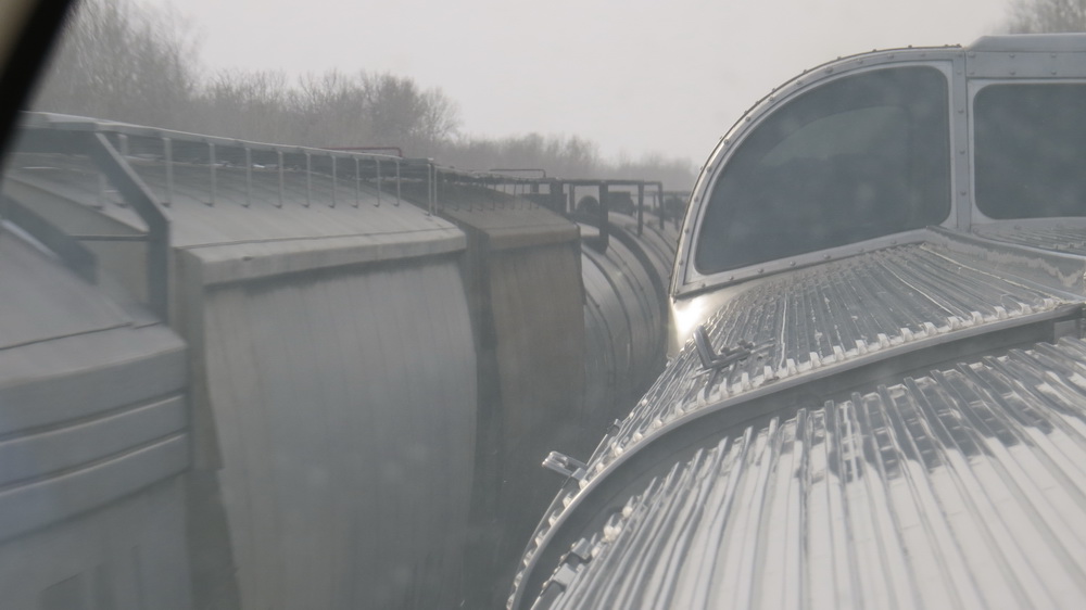
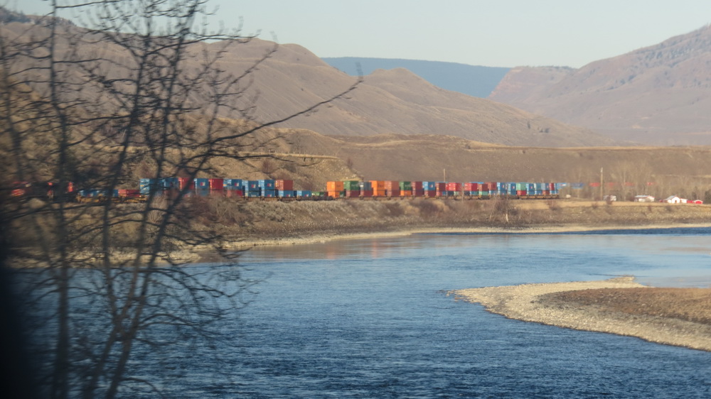
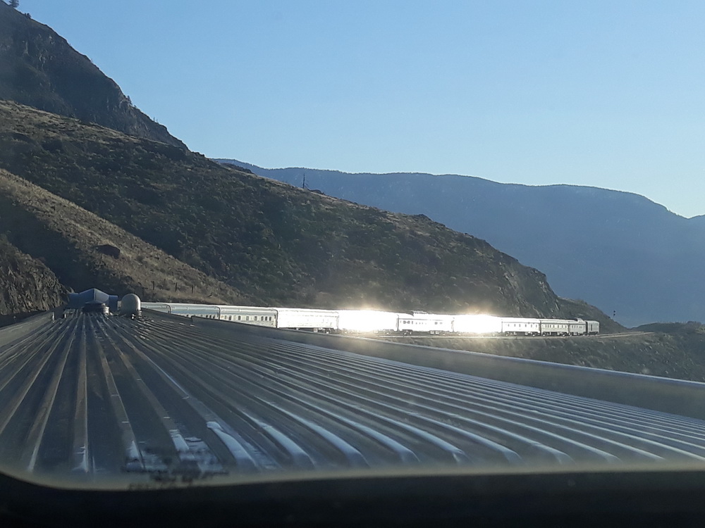
Beyond the window, we were also treated to the sight of a working railway as two-mile-long freight trains passed us by, or we passed them when they were parked up. We were lucky enough to catch a semi-fileted double-stack, which you might also call a toupee.
Other sights
At other times, from the back of the observation car, we could look towards the end of The Canadian and count the number of cars (I think there were sixteen in total, pulled by two engines at the front). I took this shot because we noticed the luggage car, now at the back due to the curious incident of the bog in the night time when the air pressure failed to flush the… and so on. It was travelling with its door open. We were convinced our luggage was going to fall out, but no, all remained well.
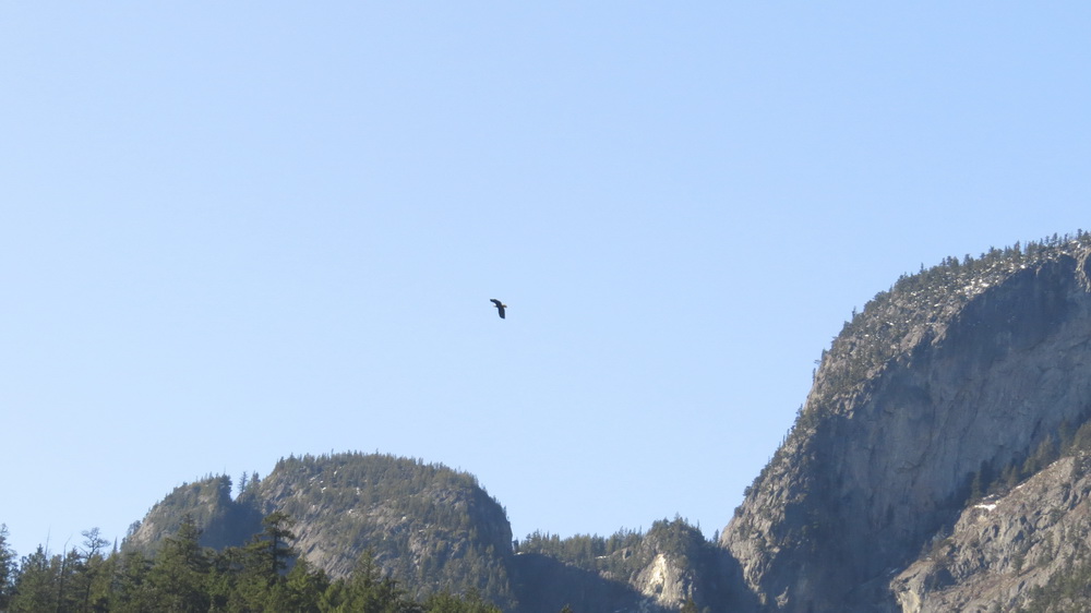
We did see a fair few bald eagles flying around, though they’re not easy to capture on a mobile phone through a window.
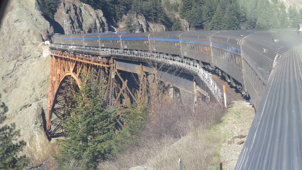
And then there were the tunnels cut into the cliffs where all kinds of safety engineering had taken place. Sometimes, there were slides to take rockfalls over the tracks and away from the trains, and at other times, there were electrified cables or nets which sound alarm bells somewhere if they are touched by falling scree. Not long after returning home, we saw a programme about this and how specialists respond to these falls by blowing up parts of the hillside. That’s’ reassuring, and obviously necessary.
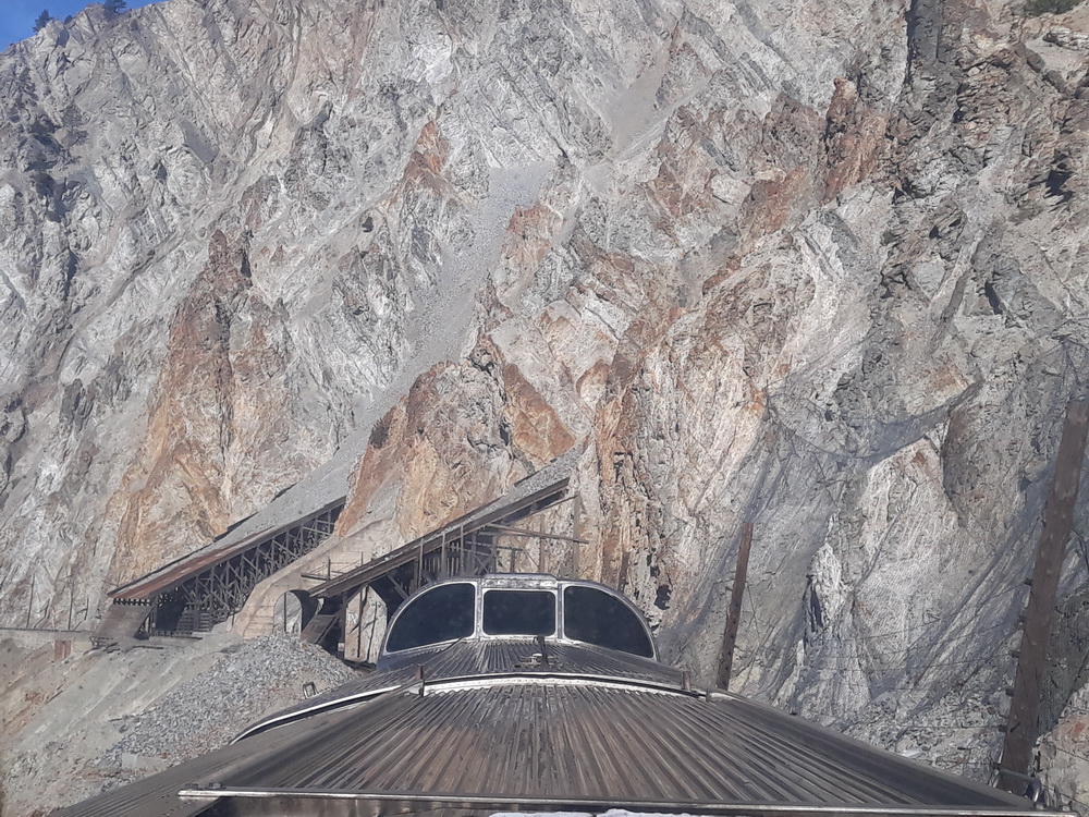
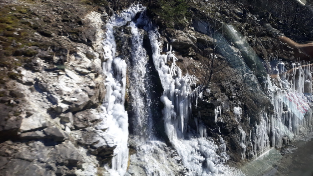
I can’t remember how many tunnels we passed through, but we were often plunged into darkness for a while, emerging on the other side to see where the runoff had frozen, and were reminded that, although we were toasty inside and the sun was shining, it wasn’t that warm outside.
As the day progressed, the landscape became more industrial, and we reached the outskirts of Vancouver. At this point, there was more talk of hand-washing and keeping a sensible distance, but there was no trepidation, and we were told Vancouver was safe and unaffected. From what?
It wasn’t until later when we could reconnect to the net and talk with people who hadn’t been incommunicado for the last five days, that we learnt the WHO had announced a worldwide pandemic while we were chugging obliviously past snow and trees. It was something of a shock, but not one that was going to mar anyone’s holiday.
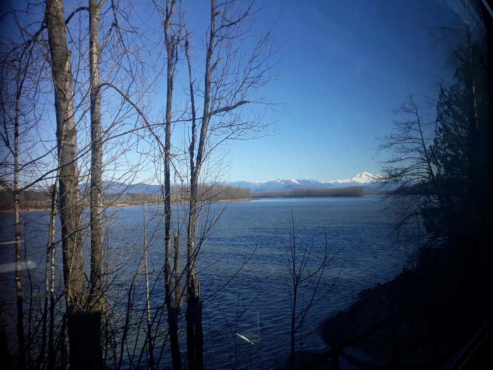
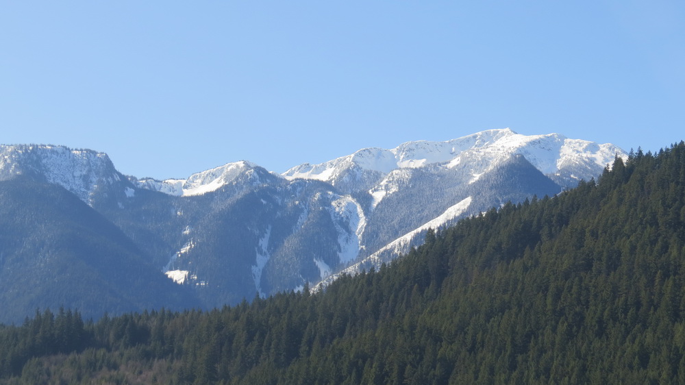
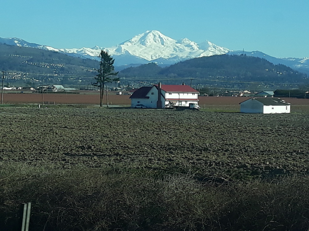
Anyway, there was Baker Mountain to admire just over the border in the USA.
Vancouver
The last leg of the journey was tedious. I can’t put it any other way. We’d done the cabin thing and packed, checked everywhere for anything Neil might have left, made sure we had the bears, and that was that. Then we learnt we’d be another two hours starting and stopping through the suburbs and industrial parts of the city, so we had a drink, and waited, and had a drink, and waited, and the bar closed. Then we were told another hour, and the afternoon dragged on. We gathered outside our cabins to chat and look at the barely moving scenery, and there may have been a cheer when we crossed a river because we thought we were getting somewhere…
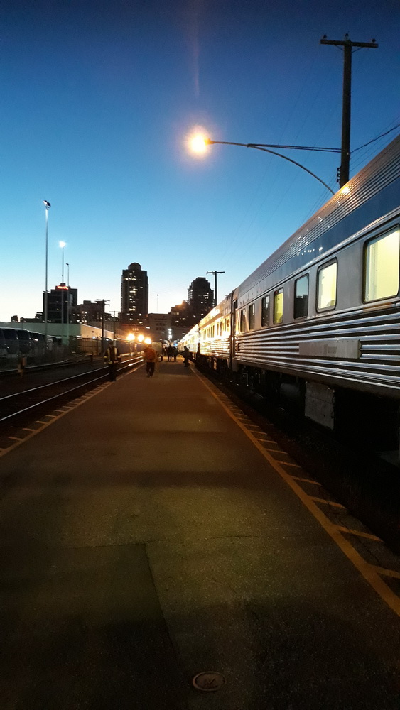
But then we’d stop for another 20 minutes by a graffitied wall or outside a shopping centre so near and yet so far, and then jolt into action at two miles an hour for another fifty yards. And hiss to a stop again, and wait… But, of course, we did finally arrive at Vancouver station, not, as the itinerary had said, at 08.00 in the morning, but sometime around sunset or just after.
From there, it was a question of collecting our bags and being reassured they’d not dropped out of the open door, thanking the staff, and gathering to meet a coach which, I hope, hadn’t been waiting for us since the due arrival time. It was a brief, night-time journey to our hotel…
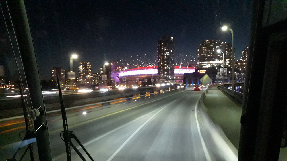
… which was situated on Robson Street, and turned out to be a five-star with rooms even bigger than the ones in Toronto. Lifts were involved again, but I’ll tell you about that tomorrow, as there are more adventures yet to come.
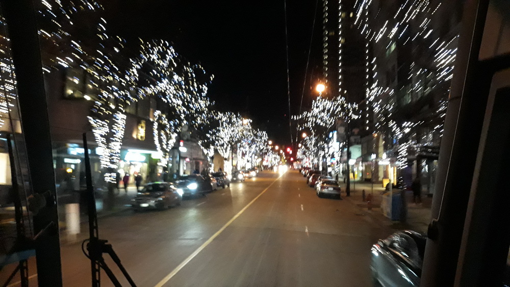
My last couple of images of that night show you the street as we approached the hotel…
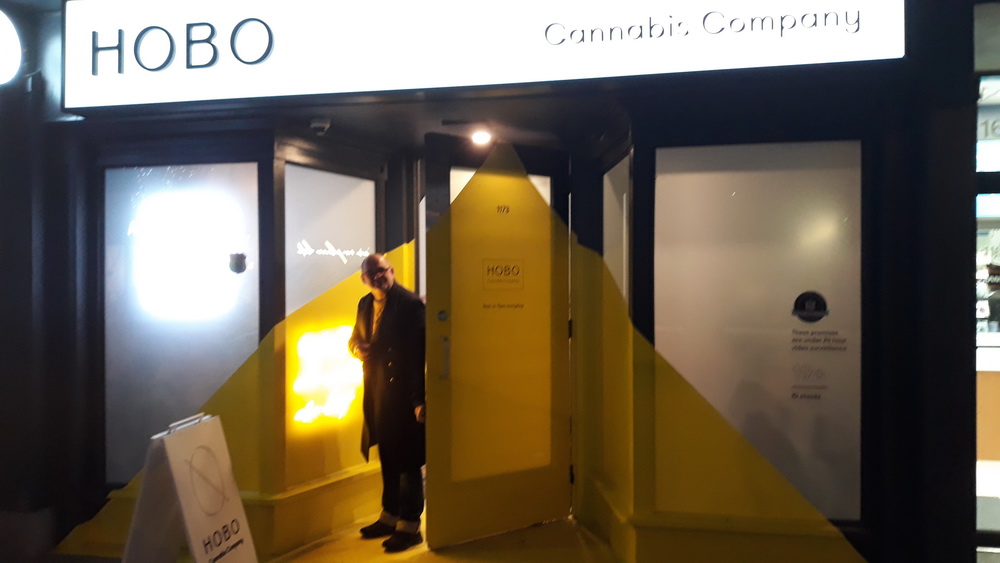
And, believe it or not, that was taken before we discovered a delightful shop a few doors down from the hotel…
But, again, more about that tomorrow, a day which also included totem poles, a curry, bears (of course) a steam clock, another bloody scenic elevator, and food.
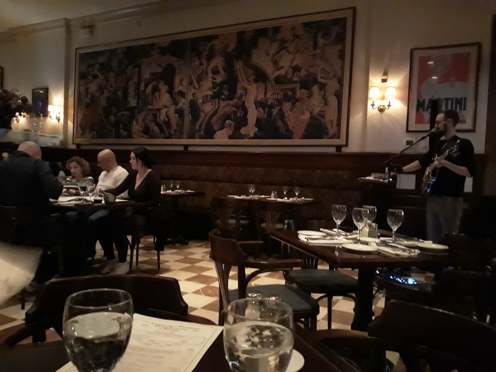
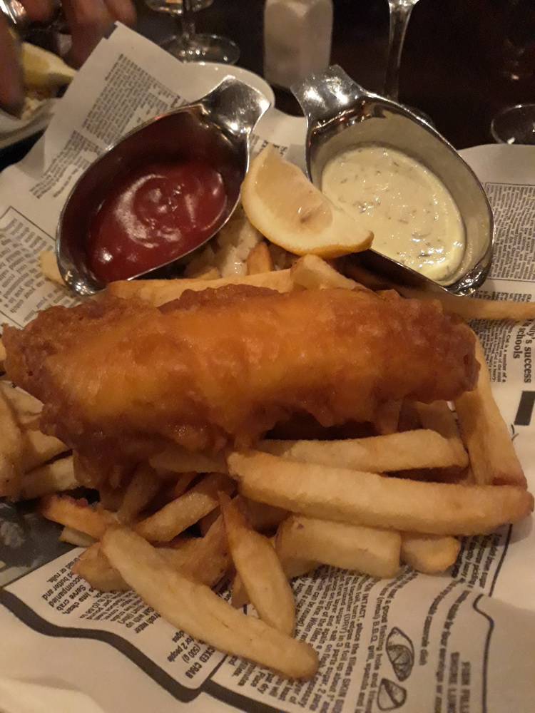
Talking of which, our first stop was a late supper with live music. A perfect end to the day.
And, to finish, a few more photos from the day at random.